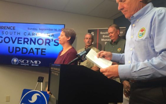
Florence begins track out of South Carolina. But SC officials still warn of dangers

At least five South Carolinians have died as result of Florence that has continued to batter parts of the Pee Dee and Piedmont regions.
South Carolina Gov. Henry McMaster said on Saturday people need to be most aware of possible flash flooding in their neighborhoods.
For those who died, McMaster offered his thoughts and prayers for their loved ones.
“We have seen the end of the hurricane and most of the storm,” he said. “(But) it is still raining. The second phase of our work has already begun. It has been well prepared for. We have troops, law enforcement, first responders and others stationed all over the areas of immediate concern now.”
Now a tropical depression, Florence was 40 miles west of Columbia by 2 p.m. Sunday, heading north-northwest at 10 mph with maximum wind gusts at 35 mph.
The National Weather Service of Columbia said on Sunday the storm is expected to accelerate north across the Upstate, where it will leave S.C. shortly thereafter. The highest rainfall was recorded in Swansboro, N.C., at almost 34 inches. In South Carolina, the highest was more than 17 inches in the Horry County area.
Areas in the Pee Dee and Grand Strand have recorded rainfall totals of between 12-17 inches.
Flash-flood watches and warnings are in effect for much of the northern Midlands and Grand Strand area, including the Upstate. Lancaster, Cheraw and Pageland are under a flash-flood warning until 8 p.m. Sunday.
“If you are under a flash-flood warning, be prepared to take immediate action,” said John Quagliariello, meteorologist for the National Weather Service of Columbia. “
The National Weather Service said there is a tornado watch from the Grand Strand to Florence until 5 p.m. Sunday.
There is some good weather-related news for South Carolina: the National Weather Service said, beyond Tuesday, forecasts show a stretch of dry weather for pretty much the rest of the week.
State emergency officials said on Sunday they are most concerned for roads leading toward Horry County, which are expected to be submerged by rain late Monday or Tuesday, the S.C. Department of Transportation said.
State Transportation Secretary Christy Hall said DOT has 2,300 employees on duty to respond to the storm. Of those, 531 employees are stationed in the Pee Dee area.
As of early Sunday, about 75 road closures were reported across the state due to flooding or downed trees.
State officials said U.S. 378 will likely be the only available route for access into Horry County. The DOT will construct a temporary, one-mile barrier on the Lynches River in Florence County.
The U.S. 501 Bypass also is expected to be the only route crossing the Waccamaw River leading into the Myrtle Beach area, DOT said. The DOT said it will place a temporary, 1.5-mile barrier on the 501 Bypass in Conway.
Meanwhile, nine miles of I-95 near the N.C. border are blocked due to flooding. Motorists are advised to take interstate routes in central and western South Carolina and avoid I-95.
State officials urged caution to coastal evacuees heading back to their homes on Sunday.
Drivers should avoid driving in standing water and driving around barriers.