- As city leaders consider expanding at-risk zone for wildfire damage, home builders say it could raise costs
- Is your neighborhood at high wildfire risk? | Here's how to check the city's wildfire risk map
- 'Be prepared now': Brad Panovich updates severe weather risk for Sunday
- 'Be prepared now': Brad Panovich updates severe weather risk for Sunday
- As anxiety around wildfires grows, Austin plans to add tens of thousands of acres to risk map
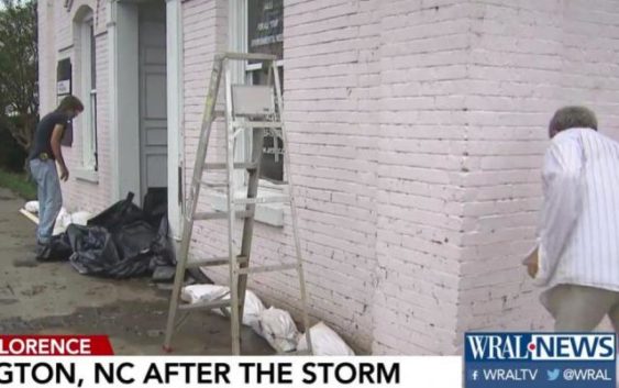
Along Washington riverfront, business owners begin cleanup following Florence
Map: Videos, images | Shelters, roads by county | Images: Florence’s impact
Get help, give help | NC’s worst hurricanes | River flooding forecast
In Washington, the Pamlico River left its watermark on the riverfront. Even heavy sandbags couldn’t keep Hurricane Florence’s 3 to 4 feet of floodwaters out of nearby businesses.
Along the riverfront, boats that were not locked down to the docks were taken out into the open river and secured.
Todd Rodzen said he did whatever he could to protect his sailboat.
“I put the boat on a hurricane-safe marina,” Rodzen said. “I also added a couple anchors.”
The floodwaters also pushed their way into neighborhoods not far from the Pamlico River.
“This is the worst I’ve seen the storm surge, and I’ve been here since 2005,” said Garcy Ward, a Washington resident.
Storm debris was piled along the curbs while some homeowners still try to get rid of the water.