- Seven months after Hurricane Helene, Chimney Rock rebuilds with resilience
- Wildfire in New Jersey Pine Barrens expected to grow before it’s contained, officials say
- Storm damage forces recovery efforts in Lancaster, Chester counties
- Evacuation orders lifted as fast-moving New Jersey wildfire burns
- Heartbreak for NC resident as wildfire reduces lifetime home to ashes
Florence flooding: Drone footage shows hurricane damage in Wilmington area
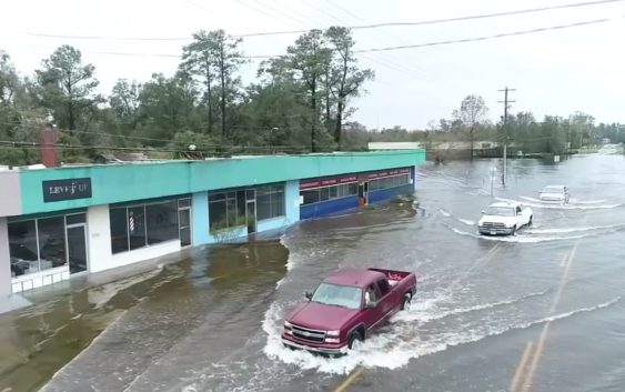
WILMINGTON, N.C. (WTVD) —
Hurricane Florence has been lashing the Carolinas since last week.
By Sunday night, the storm dumped more than 23 inches of rain on Wilmington.
In addition to the nearly two feet of rain, Florence brought heavy winds to the area, which knocked down trees and power lines across the city.
Read more: Flooded Wilmington picking up pieces after Florence’s devastation
Video from Drone11 shows cars trying to navigate through the floodwaters in Castle Hayne.
The NC Flood Inundation Mapping and Alert Network has created an amazing piece of software that allows users to hone in on a specific river in their area and see where the water is predicted to flood out to.
Click here for a demonstration on how to use the site.
(Copyright ©2018 WTVD-TV. All Rights Reserved.)