- Colorado State University predicts above-average 2025 Atlantic Hurricane Season
- South and Midwest face potentially catastrophic rains and floods while reeling from tornadoes
- Deadly 2024 hurricanes prompt WMO to retire three names
- Body recovered in North Carolina identified as East TN man who has been missing ever since Hurricane Helene
- Report: Coastal flooding could threaten 1.4 million homes by midcentury
First Alert Mode: Marginal risk for severe weather Thursday
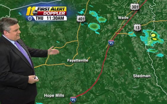
The Storm Prediction Center has put the entire area in a marginal risk for severe weather.
So what does that mean?
First the Risk:
Where is this coming from?
There’s a disturbance working out of the Ozarks and into our area by Friday morning.
Stay on top of breaking news stories with the ABC11 News App
As a piece of energy works alongside it, out of Mississippi and into our area, it will be running into an unstable atmosphere.
That will trigger clusters of showers and thunderstorms.
Inside those storms is the potential exists for severe weather.
What type of severe weather?
As the sunset approaches, the winds start to turn with height, and any storm that gets into the wind could spin up a tornado.
The potential for this is extremely low, but there is a potential, nonetheless.
The bigger problem will be gusty winds.
As the storms develop Thursday afternoon, they will move into our area between 5 p.m. and midnight.
As they get rolling, they could produce winds over 60 miles per hour in isolated spots.
And as night falls, the air should start to stabilize and the severe threat will go away through the overnight hours.
Rain chances will return tomorrow, but the severe threat stays away.
(Copyright ©2018 WTVD-TV. All Rights Reserved.)