- Fake job seekers are flooding the market, thanks to AI
- One set of evacuation orders lifted in Caldwell County after wildfire contained
- 'We gutted every building' | Chimney Rock rebuilding after Hurricane Helene
- 'We gutted every building' | Chimney Rock rebuilding after Hurricane Helene
- Debris from Hurricane Helene provides fuel, complicates containment for spring wildfires
Florence road damage in NC tops $250M
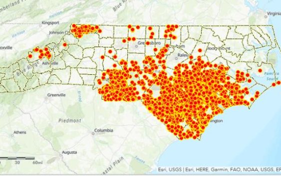
Raleigh, N.C. — North Carolina transportation officials told lawmakers Wednesday that road damage from Hurricane Florence will cost at last $266 million to repair at thousands of sites statewide. That estimate is expected to rise, Transportation Secretary Jim Trogden said, as more information comes in.
New technology, Trogden said, gave the Department of Transportation more information earlier in the storm than ever before. However, it also posed dangers for drivers using apps or social media to look for open routes.
At a meeting of a House transportation panel Wednesday morning, Trogden showed photos and videos of some of the worst damage to roads. Repairs will be needed from Ocracoke Island on the coast to Watauga County in the mountains, he said.
Florence dropped 8 trillion gallons of water on the state, he said, noting that’s about 779,000 gallons for each North Carolina resident and enough to fill the Jordan Lake reservoir about 536 times.
At the storm’s peak, Trogden said, 2,500 roads were closed. That’s now down to 127, mostly in southeastern counties. Overall, he said 3,100 sites will need repair work for washouts or other damage. He said the DOT is aiming to have temporary fixes in place at all of them within 30 days.
While federal agencies reimburse at different rates for different services by local and state agencies, Trogden estimated state lawmakers would need to allocate at least $66 million as the required match to draw down federal money. That could happen as early as Oct. 15, when lawmakers return to Raleigh to work on a larger disaster relief package.
Technology’s impact
One of the biggest challenges the DOT faced, officials said, was the rapid fluctuation of floodwaters on and off roads in the affected areas. Technology played a bigger role than ever before in helping to monitor that in real time.
“I was telling folks, ‘Don’t assume that a road that was open this morning will be open this afternoon,'” Trogden said. “That was a very dynamic process.”
Florence was the first storm in which the state has been able to use drones to look for flooding and road damage, he said. North Carolina is currently the only state that can manage drones and helicopters within the same airspace during recovery efforts. Unmanned air systems pilots flew 260 missions just for DOT, plus others for the State Highway Patrol and other emergency responders.
“We lost roads, we regained these roads, and we lost them, and we’re not talking about secondary roads. We’re talking about major highways,” said State Traffic Engineer Kevin Lacy.
Drone surveillance helped engineers monitor the ebb and flow of floodwaters to estimate changes in road conditions, Lacy said. “We were trying to estimate when we were going to lose a road. We were trying to pump as many agency resources in these areas as we could.”
State Aviation Director Bobby Walston said dramatic footage captured by state drones helped keep the public off roads in the storm’s wake, including a viral image of a flooded Interstate 40 that captured international attention and more than 2 million views on Facebook.
“I think it was these type things,” Walston said, “that really drove home to people perhaps sitting in their homes thinking, ‘Next week, I’m going to get down to my beach place,’ or ‘I’m going to be able to make that trip,’ realize, ‘They’re not kidding. These are very, very serious things.'”
Drones also helped officials watch over traffic detours in real time, even in areas where the DOT doesn’t have stationary cameras available, he said.
“We could put up a drone like it was on a pole,” Walston told lawmakers, “and monitor what was happening.”
However, Lacy said, technology also posed challenges and even dangers to drivers who used navigation apps and social media to try to find ways around flooded roads.
Those apps and posts aren’t updated in real time to reflect rapidly changing conditions, Lacy said, sometimes sending drivers “from one roadblock to the next.”