- South and Midwest face potentially catastrophic rains and floods while reeling from tornadoes
- Deadly 2024 hurricanes prompt WMO to retire three names
- Body recovered in North Carolina identified as East TN man who has been missing ever since Hurricane Helene
- Report: Coastal flooding could threaten 1.4 million homes by midcentury
- Caught on camera | Tornado touches down in Missouri
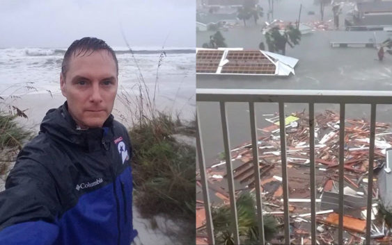
Ryan Korsgard tracking Hurricane Michael: Storm slams Florida Panhandle

ROSEMARY BEACH, Fla. – The lights went out where we’re staying in Rosemary Beach, Florida Wednesday afternoon, just off of FL-30A.
The wind is howling, as we are just west of Hurricane Michael’s eye wall. The wind measurements show Michael is just shy of a Category 5 hurricane. As it stands, it is the strongest hurricane to ever hit the Florida Panhandle.
Our last live broadcast was at noon Wednesday. After then, we changed positions after a sheriff’s deputy told us that the power lines down the street had just fallen. Using my handheld wind meter, I measured winds gusting up to 133 miles an hour. It has grown much stronger.
For now, we are hunkering down inside a home in Rosemary Beach and trying to stay away from windows. At times, the winds are so high that you fear the windows will blow in. As of Wednesday afternoon, we are about three blocks or so from the Gulf of Mexico. I do not fear the rain and the storm surge in this spot, however, the biggest concern is the high winds.
I will update this post as our connection allows. Soon, I will be saving battery power as the time for charging phones etc. has ended. We are operating on battery power at this point.
Copyright 2018 by KPRC Click2Houston – All rights reserved.