- National memorial to honor NC firefighter who died on duty during Hurricane Helene
- Gov. Josh Stein extends State of Emergency for western NC wildfires
- Gov. Stein extends state of emergency for NC wildfire threat
- Governor Stein extends state of emergency for NC wildfire threat
- Governor Stein extends emergency in 34 NC counties amid wildfire threat
10 a.m. update: Tornado watch issued as Michael threatens NC
Tropical Storm Michael made its way into the Carolinas Thursday morning, but a more westerly track means less rain, wind for the coast
10 a.m. update: Tornado threat increases
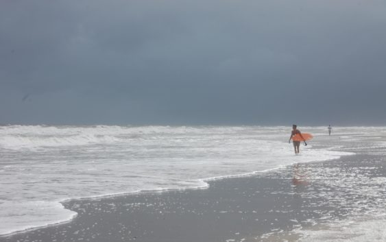
In Southeastern N.C., Tropical Storm Michael’s approach to the Carolinas was much quieter — and drier — than expected.
As of 10 a.m., only scattered showers hovered over the region, and winds were only starting to pick up strength to a sturdy breeze.
The region was placed under a tornado watch that will remain in place until 9 p.m., as storms capable of producing tornadoes moved through.
Duke Energy only reported about 150 power outages in New Hanover County, most of which had been restored by 10 a.m. A more significant outage of 142 customers in Rocky Point was expected to be fixed by 11:45 a.m., according to the Duke Energy outage map.
The region remain under a tropical storm warning with the potential for storm surge along the beaches.
— Hunter Ingram
8 a.m. update: Strong winds, less rain forecast as Michael shifts west
WILMINGTON – A shift to west overnight will spare Southeastern N.C. from the brunt of Tropical Storm Michael’s flooding potential Thursday, but winds and tornadoes still remain a concern.
Just before 8 a.m. Thursday, the sunrise was visible over the region as what was forecast to be a rainy, windy morning started out as breezy with scattered showers. But conditions are expected to degrade as the day progresses, said Victoria Oliva, a meteorologist with the National Weather Service’s Wilmington office.
Michael made landfall Wednesday afternoon as a monster category 4 hurricane near Mexico Beach along the Florida Panhandle. Since then, it weakened into a tropical storm, and began a track toward the Carolinas that was a little more west then meteorologists previously forecast.
“The more western track may relieve some of the flash flooding threats for our area, but we are still worried about gusty winds given what Florence did to us,” Oliva said. “With everything still saturated, downed trees and power lines are still possible.”
On Thursday, the region is now forecast to see between half an inch and three inches of rain, with those higher amounts more likely for more western parts of the area. Most of the rainfall will be scattered throughout the day.
Despite the shift west, wind forecasts throughout Thursday have not changed with sustained winds of 25-30 mph expected and gusts of 40-45 mph possible.
The threat of tornadoes also remains active throughout the day.
Michael continues to move at a breakneck pace, pushing northwest at 20 mph. For comparison, Hurricane Florence was inching along at 2-3 mph when it made landfall over the region on Sept. 14, dropping upwards of 30 inches.
“Speed makes quite a lot of difference in terms of rainfall,” Oliva said.
— Hunter Ingram
Reporter Hunter Ingram can be reached at Hunter.Ingram@StarNewsOnline.com.