- Report: Coastal flooding could threaten 1.4 million homes by midcentury
- Caught on camera | Tornado touches down in Missouri
- Carolina Hurricanes playoff tickets go on sale next week
- Storms kill 6 in the South and Midwest as forecasters warn of catastrophic rains, floods this week
- Weather Impact Alert: Cold front could trigger severe weather in Houston area this weekend | See timeline
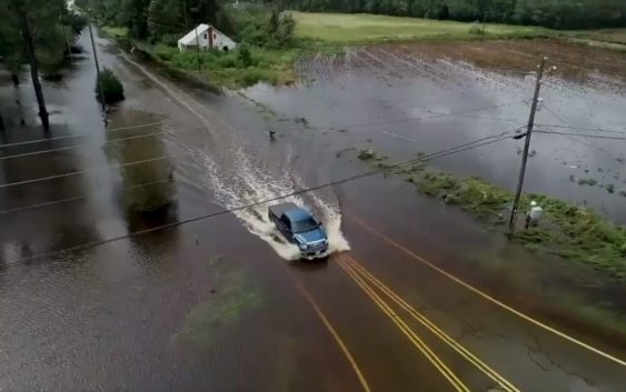
Hurricane Florence made history, breaking 28 flood records in the Carolinas

Hurricane Florence devastated the Carolinas, and now scientists have the data to back up what Carolinians suspected in the wake of the storm.
Florence was a historic storm, breaking 28 flood records across North and South Carolina, according to a recent study by the U.S. Geological Survey.
Data from at least 18 USGS streamgages in North Carolina and 10 in South Carolina show what the USGS calls “peaks of record.”
Another 45 gauges in North Carolina and four in South Carolina show “record streamflows — the volume of water moving past a fixed point — within the top five” levels ever measured at those sites, according to the study. The gauges regularly measure the levels of creeks, streams and rivers and how much water is flowing through them across the Carolinas.
Premium content for only $0.99
For the most comprehensive local coverage, subscribe today.
#ReadLocal
The records Florence broke weren’t that old.
“One thing we discovered while compiling this report was many of the new peaks of record set by Hurricane Florence broke previous records set by Hurricane Matthew in 2016,” Toby Feaster, USGS hydrologist and lead author of the study said in a statement. “Since several of the streamgage sites we analyzed had more than 30 years of historical data associated with them, it was interesting that a majority of the number one and two records were from back-to-back flooding events.”
Knowing the “expected frequency and magnitude” of flooding can help emergency managers, engineers and community leaders craft building codes and other planning policies, according the study.
Florence came ashore as a Category 1 hurricane on Sept. 14 near Wrightsville Beach. For days after, the storm dumped historic rain across North and South Carolina.
The study focused on 84 separate streamgages across the two states, but there are 485 in total in the Carolinas. Authors of the study chose to focus their efforts on the gauges that had been recording data longer and where Florence caused historic flooding.
“We made the decision to only include streamgages in this report with at least a decade of historical data, because a new peak of record at a site with only a few years of history doesn’t really provide very useful information,” Feaster said. “We also decided to stick with at least 10 years of historical records because that is the minimum required for flood frequency analysis.”
Some of the areas had more than 70 years of data for flood records, according to the study.
The Waccamaw River in Freeland, N.C., peaked at its gauge on Sept. 19 — five days after Florence made landfall — with water levels reaching 22.61 feet The Waccamaw has flood data going back to 1940 and Florence caused the highest level on record, according to the study.
The Little Pee Dee River in Galivants Ferry, S.C., also saw its highest flood a week after Florence first made landfall – 17.21 feet at its peak, the highest in at least 77 years, according to the study.
Studying the flood levels following major weather events such as Florence can help provide insight into future floods, according to the study.
Of the 28 record-breaking sites in the Carolinas:
▪ nine had a less than 1 in 500 chance of flooding to that level in any given year;
▪ three had a 1 in 500 chance;
▪ six had anywhere between a 1 and 500 chance or a 1 in 100 chance;
▪ 10 had a 1 in 67 chance or greater of flooding to that level.
Some of the areas with peak flooding from Florence, followed by how long the data has been tracked:
▪ Northeast Cape Fear River near Chinaquapin, N.C. (78 years)
▪ Waccamaw River in Flreeland, N.C. (77 years)
▪ Little Pee Dee River at Galivantis Ferry, S.C. (77 years)
▪ Cape Fear River at William O Huske Locke near Tarheel, N.C. (71 years)
▪ Black River near Tomahawk, N.C. (70 years)
▪ Waccamaw River near Longs, S.C. (68 years)
▪ Trent River near Trenton, N.C. (67 years)
▪ Little River near Star, N.C. (64 years)
▪ Black Creek bear McBee, S.C. (59 years)
▪ Black Creek near Hartsville, S.C. (58 years)
▪ Flat Creek near Inverness, N.C. (50 years)
▪ Cape Fear at Lock No. 1 near Kelly N.C. (49 years)
▪ Big Shoe Heel Creek near Laurinburg, N.C. (31 years)
▪ Lumber River near Maxton, N.C. (30 years)