- Fake job seekers are flooding the market, thanks to AI
- One set of evacuation orders lifted in Caldwell County after wildfire contained
- 'We gutted every building' | Chimney Rock rebuilding after Hurricane Helene
- 'We gutted every building' | Chimney Rock rebuilding after Hurricane Helene
- Debris from Hurricane Helene provides fuel, complicates containment for spring wildfires
Heavy downpours Thursday, Friday flooding possible
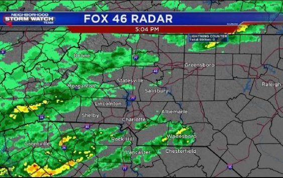
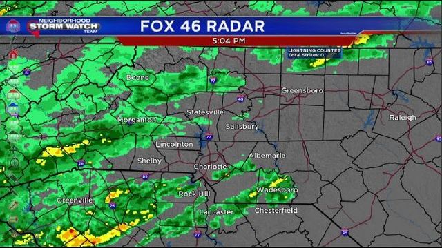
CHARLOTTE, N.C. (FOX 46 CHARLOTTE) – Neighborhood Weather Alert Days have been declared for Thursday and Friday as heavy downpours could cause flooding in parts of the area.
The overall wet pattern will continue the last couple days of this week. Scattered showers will be moving in through Wednesday night and Thursday morning. Most of the rain associated with this system will be light to moderate, and most of it will be moving out by Thursday afternoon, leaving us with a drier finish to the day Thursday.
But don’t put the umbrella away– more rain develops for Friday afternoon and night. This round could be heavy at times, leading to more flooding issues in parts of the region. If you’re hoping for a drier weekend, you’ve got it coming. Besides a few lingering showers early Saturday morning (even some snowflakes in the mountains), it’s back to sunshine Saturday afternoon through Sunday. Temperatures will be warming up again over the weekend, too– mid to upper 60s by Sunday! Monday is still dry as well.
Wednesday night: Mostly cloudy, scattered showers. Patchy fog. Low 49.
Thursday: Morning showers, tapering off in the afternoon. High 59.
Friday: Rainy & cool. 48/56.