- Seven months after Hurricane Helene, Chimney Rock rebuilds with resilience
- Wildfire in New Jersey Pine Barrens expected to grow before it’s contained, officials say
- Storm damage forces recovery efforts in Lancaster, Chester counties
- Evacuation orders lifted as fast-moving New Jersey wildfire burns
- Heartbreak for NC resident as wildfire reduces lifetime home to ashes
EF-2 tornado touched down in Orange County last week

The National Weather Service on Monday shared new details about a series of tornadoes that touched down in North Carolina during Friday’s severe storms.
According to NWS, eight tornadoes were confirmed in central North Carolina on April 19 between 3 p.m. and 7 p.m. No injuries or deaths were reported.
EF-2 tornado reported in Orange County
One of the tornadoes was classified as an EF-2 storm. Unlike EF-1 tornadoes, which are more common in North Carolina, EF-2 tornadoes are classified as “strong” and move between 111 and 123 mph.
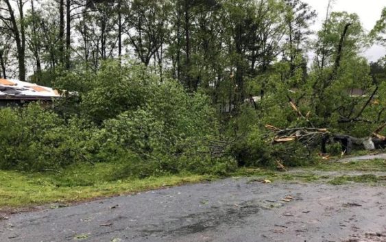
The EF-2 tornado touched down in Orange County on April 19 near White Cross Road and Leslie Drive in Chapel Hill before moving toward Hillsborough via Dodsons Cross Road, Dairyland Road, Arthur Minnis Road and Borland Road.
It snapped and split healthy trees, damaging homes and cars, before dissipating north of Interstate 40 near Exit 261.
The EF-2 tornado was on the ground between 4 p.m. and 4:15 p.m., according to the National Weather Service.
Other confirmed central NC tornadoes
Other confirmed tornadoes from Friday’s storms include:
- An EF-1 tornado touched down northwest of Rocky Mount. The storm traveled 12.5 miles on the ground (for a total of 11 minutes, between 6:08 p.m. and 6:19 p.m.) and had a width of 350 yards.
- An EF-1 tornado touched down southwest of Weldon and traveled for 5.1 miles between 6:34 p.m. and 6:40 p.m., crossing into Northampton County.
- An EF-1 tornado touched down 3 miles southeast of Whitakers and remained on the ground for 8.8 miles, between 6:16 p.m. and 6:35 p.m., damaging a trailer and trees.
- An EF-1 tornado touched down briefly northwest of Siler City in Chatham County. The tornado was on the ground for two minutes, between 3:45 p.m. and 3:48 p.m., and damaged trees and power lines.
- An EF-1 tornado touched down in northwest Moore County in Robbins, uprooting trees and damaging the roofs of homes. The tornado was on the ground between 3:11 p.m. and 3:14 p.m.
- An EF-1 tornado touched down in Spiveys Corner in Sampson County, snapping and uprooting trees, tossing around outdoor furniture and damaging at least one roof. The storm moved toward Johnston County between 5:01 p.m. and 5:11 p.m.
More tornadoes still need to be surveyed, or studied.
The Fujita scale classifies tornadoes as follows:
- EF-0: 65 to 85 mph (weak)
- EF-1: 86 to 110 mph (weak)
- EF-2: 111 to 135 mph (strong)
- EF-3: 136 to 165 mph (strong)
- EF-4: 166 to 200 mph (violent)
- EF-5: Over 200 mph (violent)