- Duke Energy funding $500K to aid nonprofits in NC's post-Hurricane Helene efforts
- Duke Energy funding $500K to aid nonprofits in NC's post-Hurricane Helene efforts
- If you were affected by Hurricane Beryl or the derecho storm, you could save money on your income taxes
- Tips for filing your taxes if you were a victim of a natural disaster like Hurricane Beryl or the derecho storm
- Rain chances ramp up midweek; low-end severe weather risk
FORECAST: Historic Flooding For Some

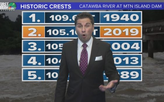
The flooding we saw in the foothills was devastating and even historic. The Catawba River at Mountain Island Dam crested to its 2nd highest level on record. A few rivers reached a stage below major flooding and dozens of roads we covered with water and even washed away!
A Flash Flood Watch is in effect for a handful of us until 6AM this morning and will come with a drier morning. There is a better chance for scattered showers and even a few storms during the afternoon BUT the rain won’t be as slow moving as what we have had over the last few days which will limit flooding slightly. But any rain we get is not a good thing for those in Catawba, Caldwell, Alexander and Burke County. Once this cold front clears we have some drier weather moving back in.
MOST of Tuesday looks to be dry before more rain moves back in Wednesday giving the all clear by late Thursday and Friday. Friday should be sunny and feel great since this muggy air will have said goodbye. That looks to be the pick of the week so something to look forward to!
Have a great week everyone!
-Chris Mulcahy
Copyright 2018 WCNC