- David & Nicole Tepper increase Hurricane Helene relief commitment to $750k
- David & Nicole Tepper increase Hurricane Helene relief commitment to $750k
- McDowell County wildfire spreads to 500 acres, evacuation orders in place
- Evacuations in Caldwell County due to wildfire
- Northwest Houston 'ghost neighborhood' caused by repeated flooding to become latest detention basin
Wind gusts, quarter-sized hail possible Thursday
Raleigh, N.C. — Severe weather is possible Thursday evening, with the chance for wind gusts, large hail and isolated flooding, WRAL meteorologist Mike Maze said.
A front that’s bringing severe weather across the mid-Mississippi Valley, the lower Mississippi Valley and the Southern Plains on Wednesday will close in on the southeast Thursday.
“That’s the system that’s going to generate the potential for severe storms,” Maze said.
The Triangle is at a level 2 out of 5 for the possibility of severe storms, WRAL meteorologist Kat Campbell said.
While Thursday will start quiet but muggy, storms are expected to move in around 3 p.m.
Gusts could reach 40 to 60 mph, and hail could be the size of quarters or larger, Maze said.
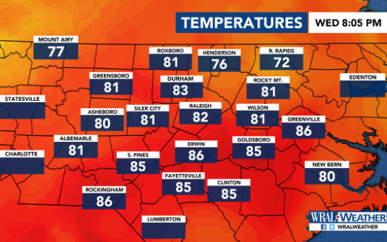
Temperatures will reach 87 degrees by lunchtime and 92 degrees in the afternoon.
There’s only a 10% chance for rain Thursday morning. That increases to 40% in the afternoon and 50% in the evening.
Once the front moves out of the area, though, things will be quiet again.
Friday looks like a good day to go to the pool or a lake, Maze said, as the official start of summer will have highs in the mid-to-upper 80s and mostly clear skies.
June 21 is known as the longest day of the year. The sun will rise in Raleigh around 6 a.m., and daylight will extend past 8:30 p.m.
