- Austin is at a 'potentially historic' risk of wildfires Tuesday. Here's how to prepare.
- South Carolina's governor declares State of Emergency as massive wildfire grows to 1,600 acres
- Staying weather alert: How to find your safe place during severe weather
- Wildfires persist across Carolinas amid windy, dry conditions
- York County crews help battle South Carolina wildfires
Severe weather moves through central North Carolina
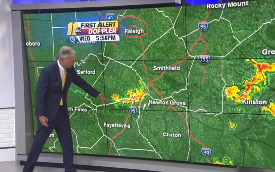
Strong storms moved through central North Carolina on Wednesday afternoon but pushed out by early evening.
As of 3:15 p.m., the strongest storms were north and east of Raleigh, and the severe threat for the Triangle had diminished. There still could be a storm through the evening especially south and east of RDU, Chief Meteorologist Chris Hohmann said.
It will be dry and a little less humid Thursday, with highs from 88-92.
There could be an isolated shower or storm Friday late or evening, with most spots dry and highs in the low 90s.
We should have a dry and warm weekend with highs near 90 and humidity fairly low, especially Saturday, Hohmann said.
Copyright © 2019 WTVD-TV. All Rights Reserved.