- Central Texas prepares for wildfire threat with expanded response
- Lighter winds help crews fighting wildfires in South and North Carolina
- Austin is at a 'potentially historic' risk of wildfires Tuesday. Here's how to prepare.
- South Carolina's governor declares State of Emergency as massive wildfire grows to 1,600 acres
- Staying weather alert: How to find your safe place during severe weather
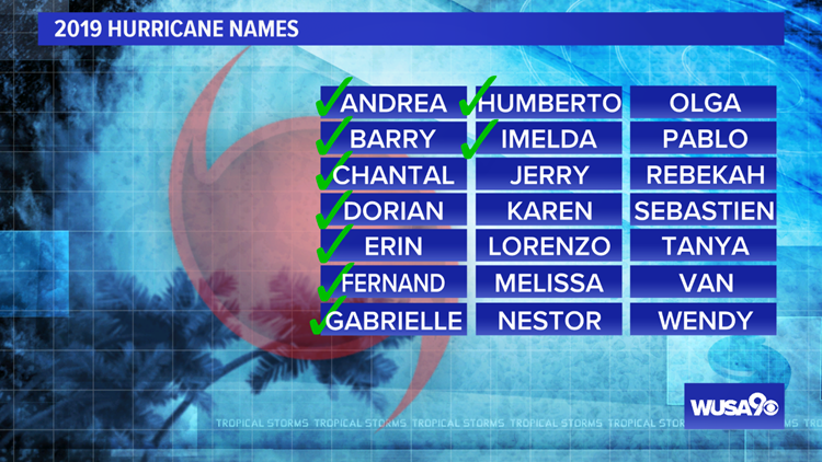
The tropical are cooking: Imelda brings flooding to Texas, Humberto heading towards Bermuda
The tropics are very active — we are tracking Humberto, Imelda, and Tropical Depression 10.

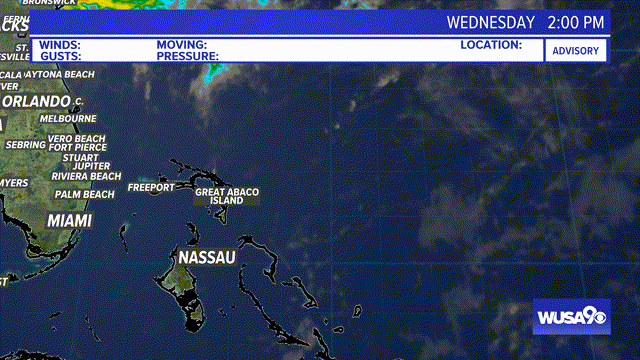
Imelda
Imelda formed Tuesday afternoon right on the Texas coastline and made landfall Tuesday night. The threats from the remnants of Imelda are heavy rain and isolated tornadoes. Bands of heavy rain will continue to be pulled onshore through southeastern Texas and western Louisiana and northward. The storm will slowly move inland over the coming days.
App users click here to see Radar loop over Imelda
Here is the 7 Day rainfall outlook over the area — this rainfall is just from Imelda. Southeast Texas will be inundated with heavy rains through at least Thursday. Rainfall totals could locally exceed 10 inches. Houston is very flat and the way the water drains out is through bayou system. This is a very slow process. We do expect flash flooding to occur and it could be life-threatening.
Here is the official track from the National Hurricane Center. As Imelda moves onshore, winds will decrease. That will not stop the heavy rainfall threat.
Below is the Futurecast, showing the tropical rains moving onshore in the next 48 hours.
Humberto
Hurricane Humberto has picked up strength. It’s now a Category 2 hurricane with maximum sustained winds of 105 mph and gusts to 120 mph. Hurricane Force winds extend 60 miles outside the center. Tropical storm force winds extend 175 miles outside the center of the storm.
A new Hurricane Warning has been issued for Bermuda, which the storm could impact Wednesday. While the latest forecast track takes Bermuda out of the forecast cone, the storm will be passing by very closely.
There is still a risk of rip currents and rough surf through Wednesday as the storm pulls further away from the US.
App users click here to see satellite loop of Humberto.
RELATED: Donations for Dorian: DC community members pack supplies for those impacted by hurricane
Here is the latest forecast track from the National Hurricane Center. Humberto is forecast to become a major hurricane before nearing Bermuda. Although the strongest part of the store will stay offshore, Bermuda will still be impacted by heavy rains and tropical to low-end hurricane storm force winds. This will depend on the final track. Beyond Bermuda, this storm is a fish storm.
RELATED: Weather Forecast for DC metro area
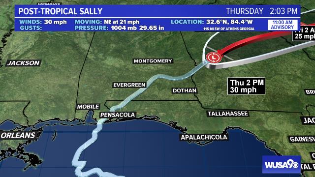
Tropical Depression 10
Tropical Depression 10 is expected to become Tropical Storm Jerry early Wednesday morning. Here is the track from the National Hurricane Center, showing the cone of uncertainty staying to the north side of the Virgin Islands and Puerto Rico. This is a storm to watch over the next week.
wusa9 weather team