- 'A little emotional': Hurricanes equipment manager got seconds in goal, memory to last a lifetime
- WMO retires three hurricane names after devastating 2024 season
- Beryl removed from future hurricane naming lists
- Hurricane names Helene, Milton and Beryl are now retired
- Hurricane Helene's name retired after deadly 2024 impact on US
Cold front expected this afternoon. Severe weather not likely.
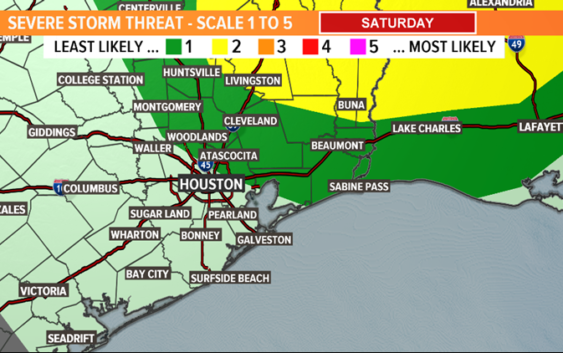
The next cold front is forecast to move through the Houston area late this afternoon. While we were monitoring the possibility of strong storms earlier this week, it appears as though that threat is minimal now at best.

KHOU
The Storm Prediction Center has all but removed Houston from the threat of severe weather for Saturday and has shifted that ‘slight risk’ area further to the north and east.
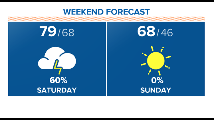
They did leave a ‘marginal’ risk for the northeast sections of the viewing area but ‘marginal’ is the lowest risk category they assign. So we’ll keep an eye out but I’m not anticipating much for today other than passing downpours as the front moves through.
The second half of the weekend is looking FABULOUS with high pressure building in. The will bring back sunny skies and more fall-like temperatures Sunday.
RELATED: Houston forecast: Cloudy and cool Thanksgiving Day with a small rain chance
KHOU