- Austin could see heavy rains, possible flooding over the next few days
- Families of campers, counselors who died in Texas Hill County floods sue Camp Mystic
- Small plane bound for Jamaica with hurricane relief supplies crashes in Florida neighborhood
- Ask the Meteorologist: Did a tornado hit Johnston County Saturday night?
- Demolition begins on flood-damaged homes in Stoney Creek as neighbors await relief
New Houston-Area Rules To Prevent Flooding Are ‘Obsolete On Arrival’, Some Experts Say
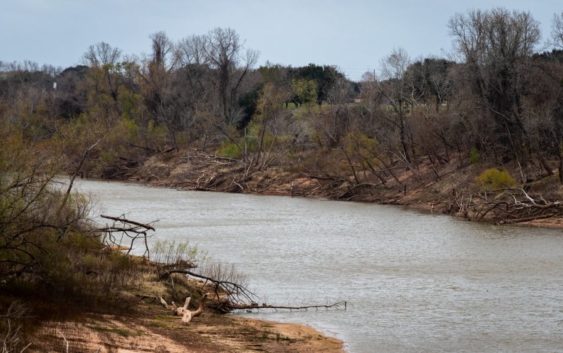
Brazos River in Fort Bend County.
Fort Bend County officials are the latest in the Houston area to implement stricter development requirements to prevent flooding, with new regulations that went into effect on January 1.
They’re now requiring developers to plan for more rainfall — a 30% increase over their prior estimates, which were based on rainfall data from 1960. But according to some experts, the new estimates would need to be doubled in order to be effective for planning purposes and they could be “obsolete on arrival.”
The purpose of having drainage criteria is to keep development from flooding neighboring properties, Fort Bend County Engineer Mark Vogler said. The county already has a reputation for implementing strict requirements, like more stringent allowable runoff rates compared to Harris County or Montgomery County.
“We get a lot of pushback from developers and engineers. Those guys are in business to make money. We’re in business to protect the public,” Vogler said. “They end up cooperating with us but again they want to make sure what they have to do everybody has to do and we do have very detailed requirements and very significant requirements. We get a lot of comments about that.”
Now Fort Bend County is strengthening its drainage criteria and minimum slab elevation criteria, requiring developers to plan for 16.5 inches of rain in 24 hours, up from the previous requirement of 12.5 inches. But how do they know how much extra rainfall to plan for?
 Engineer Mark Vogler of the Fort Bend County Drainage District
Like the rest of the Houston area, they’re basing their decisions on a massive nationwide study from the National Weather Service called Atlas 14, which updated rainfall estimates for regions all across the country. After the new Texas estimates were released in 2018, Montgomery County updated their regulations effective January 2019 and Harris County followed in July. Fort Bend County’s new regulations based on Atlas 14 estimates just went into effect on January 1.
The National Weather Service has said that increased rainfall in recent years is part of the new numbers. But some experts say they wouldn’t necessarily use Atlas 14 estimates to plan for the future, like engineering consultant and attorney Larry Dunbar with Rice University’s SSPEED Center.
“If I were designing my own house, designing my own detention pond,” Dunbar said, “I sure wouldn’t be using Atlas 14 rain.”
Dunbar said the Atlas 14 estimates would have to be doubled in order to plan effectively for the storms the region is currently getting.
“What do we believe is the current amount of rain that we would expect now on average to see once every 100 years — a 1% chance every year — what is that amount of rain? It’s probably not 16 to 18 [inches]. It’s probably double that,” Dunbar said.
If the Houston area really wanted to plan for a 100-year storm, he said, officials would require developers to design drainage and detention for at least 30 inches of rainfall. It’s not necessarily a popular perspective, Dunbar said.
“They’re like, ‘Well yeah, Larry, but gee, if we use 35 inches of rain for the 100-year and we do our floodplain maps, look at all the property that’s going to be in the 100-year floodplain, my goodness, across Harris County. We can’t do that.’ And I’m like, ‘Well why not?’” Dunbar said.
Be that as it may, engineers will now spend years and lots of money to update systems to reflect Atlas 14 rainfall estimates. These figures will help them determine what elevation to build to, how much detention to require and where to draw the boundaries of new floodplain maps.
“We’re going to update our Brazos River floodplain map and model to more accurately represent what’s out there and so that floodplain could change,” Vogler said. “And then we’re looking at 41 major creeks and streams in the county. We’re going to use Atlas 14 rainfall on all those, create brand new models to better represent to the public what the floodplain really looks like. And then that information could be used to create new floodplain maps for those channels and for the river in Fort Bend County.”
But environmental lawyer and Rice University professor Jim Blackburn said those estimates are too low to be relied upon for planning purposes.
“I believe it’s going to be obsolete upon arrival when we get the new 100-year floodplain maps,” Blackburn said.
One problem he and others see is that rainfall estimates are hardly ever updated. Until now, Fort Bend County’s criteria was based on rainfall data from 1960. Experts say it could be decades before there’s another update.
“I do not think this is about catching up and certainly not about getting ahead,” Blackburn said.
Fort Bend County engineer Mark Vogler agreed that adopting Atlas 14 estimates isn’t necessarily about getting ahead. But he says Fort Bend County is looking to the future — after completing a multi-million dollar study of the Brazos River watershed, they will present their results to the public, and the community will decide how much they want to invest.
“So we’re taking it a step at a time as we know things are occurring and that’s our next step,” Vogler said. “To see what the public wants to do, how we need to work forward, what they’re willing to accomplish to protect themselves from flooding.”