- McDowell County wildfire spreads to 500 acres, evacuation orders in place
- Evacuations in Caldwell County due to wildfire
- Northwest Houston 'ghost neighborhood' caused by repeated flooding to become latest detention basin
- NHL playoffs: Hurricanes open playoffs Easter Sunday afternoon vs. Devils
- 2 wildfires spreading in rugged terrain in western North Carolina
Severe weather, flash flood threat late Friday night
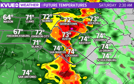
AUSTIN, Texas — A West Coast storm system is heading to Texas and will be a big rainmaker for much of the state Friday night into Saturday morning.
Friday afternoon will be warm and breezy with highs in the 80s to around 90 degrees. A few isolated showers will be possible.
The best chance of rain will enter the area late Friday night into Saturday morning. A few strong to severe storms will be possible, producing hail and gusty winds. Heavy rainfall could also trigger flash flooding and creek and river flooding. Low water crossing closings will be possible early Saturday morning.
Rainfall chances will decrease starting late Saturday morning and through the afternoon hours.
Widespread rainfall amounts of two to four inches will be possible. Isolated higher totals will also be possible.
Highs this weekend will be in the 80s. Rain chances will be much smaller starting on Sunday.