- National memorial to honor NC firefighter who died on duty during Hurricane Helene
- Gov. Josh Stein extends State of Emergency for western NC wildfires
- Gov. Stein extends state of emergency for NC wildfire threat
- Governor Stein extends state of emergency for NC wildfire threat
- Governor Stein extends emergency in 34 NC counties amid wildfire threat
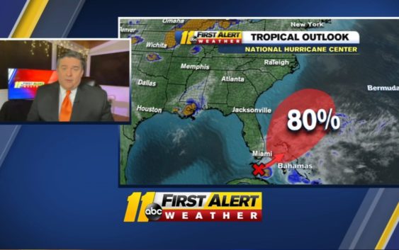
First tropical system of the year – Tropical Storm Arthur – has 70 percent chance to form this weekend

It appears that conditions are favorable enough for this to develop into a tropical or subtropical depression or storm as we head into the weekend. The big question is: does it have any impact on North Carolina?
Right now, the answer looks to be: not much.
The low pressure system, in whatever form it takes, is forecast to track to the northeast and stay a few hundred miles off our coast by early next week. On this track, there could be a few showers on the Outer Banks by early in the week.
It’s unlikely that it will get as strong as a hurricane-winds of 74 mph or higher-because the waters off our coast are still too cool. Most water temperatures right now are in the low and mid 70s, and you need water temperatures of at least 80 degrees for a tropical system to really thrive.
The biggest threat to our coast on the forecast path would be rough surf and dangerous rip currents. And we all know that rip currents can be deadly if you don’t know what to do if you get caught in one.
Lots of quarantine weary folks could be headed to our beaches this weekend, so be extra careful if you’re one of them.
If the storm develops as expected and gains winds of at least 39 mph, it’s name would be Arthur. The last time the name Arthur was used was in 2014. It was an early season hurricane that struck the Outer Banks right before the 4th of July. That was the earliest in the season that a hurricane ever hit North Carolina.
Copyright © 2020 WTVD-TV. All Rights Reserved.