- Stress, shelter, and safety: Hurricane Helene's effect on domestic violence victims in NC
- Country music's biggest stars hold 'Concert for Carolina' to help Hurricane Helene victims
- Jarvis stars as the Hurricanes beat the Kraken 4-1 for their 3rd straight win
- Houston Cougars take on A&M Aggies in charity exhibition game supporting Hurricane Beryl relief
- Hurricane Helene donations delivered to Avery County for Share the Warmth campaign
Live Blog: Damaging winds moving through Charlotte
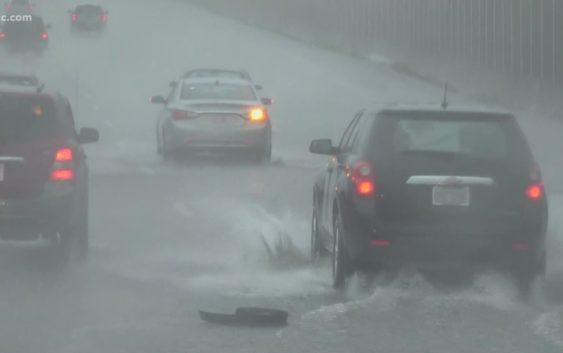
Storms will produce a risk for damaging winds. An isolated tornado cannot be ruled out. A flooding threat is also possible after days of rain caused saturated soil.
CHARLOTTE, N.C. — A line of strong-to-severe thunderstorms are forecast to move through Charlotte and the surrounding Carolina communities Friday. The storms will contain a risk for damaging winds, isolated tornadoes, and a flood threat, which is amplified by saturated grounds and swollen rivers cause by days of prolonged rainfall.
This is a live blog from WCNC Charlotte and the First Warn Storm Team. Refresh this page for real-time severe weather updates. We will be live coverage on WCNC Charlotte and streaming here throughout the evening.
Numerous tress down across the area
All across the Charlotte metro and the greater Piedmont region, numerous trees have fallen because of ongoing severe thunderstorms.
Power outages have been reported as a result of downed tress and powerlines.
Damaging winds picked up outdoor furniture, including in one location where a trampoline was pinned in the trees.
Tornado Warning for Chester County
A Tornado Warning has been issued for Chester County, South Carolina until 5:15 p.m.
Severe Thunderstorm Warning for most of Charlotte metro
A severe thunderstorm capable of producing damaging winds over 60 mph is moving through Mecklenburg County and the Charlotte metro.
Tornado Warning extended in Mecklenburg County and uptown Charlotte
The National Weather Service has extended the tornado warning into Mecklenburg County, including Charlotte Douglas International Airport and uptown Charlotte, and additional parts of Gaston County, including Gastonia and Belmont.
The current warning will continue until 4:30 p.m. and could be extended.
Tornado Warning for York, Gaston, Cleveland, and Cherokee counties
A Tornado Warning has been issued for northern York, southern Gaston, southeastern Cleveland, and parts of Cherokee counties until 4 p.m.
The severe thunderstorm is capable of producing a tornado and damaging winds as it moves east at 40 mph towards the Charlotte metro.
Locations inside the warning include, but are not limited to:
- Crowder’s Mountain
- King’s Mountain
- Bowling Green
- Clover
Severe Thunderstorm Warning: Cleveland County, North Carolina
A Severe Thunderstorm Warning has been issued for upstate South Carolina, and the southern portion of Cleveland County, North Carolina.
The warning goes until 3:45 p.m., and could be expanded as the line of severe storms move east at 40 mph. The storms are capable of producing damaging winds and damaging hail upwards of one inch.
The same line of storms cause limbs to blow off of trees as it moved through Greenville County, South Carolina.
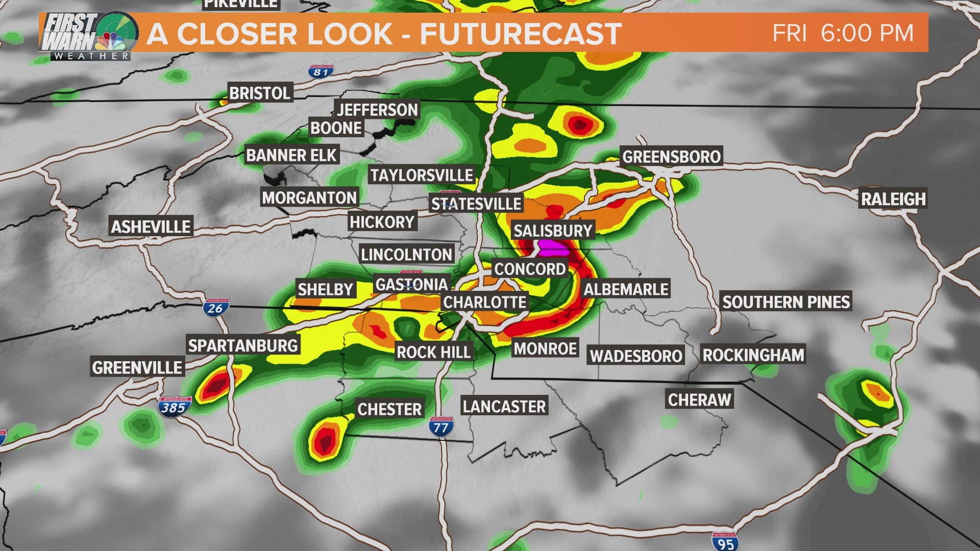
Threat of bowing line of storms
WCNC Charlotte First Warn Storm Team Meteorologist Chris Mulcahy says a forecasted “bowing” line of thunderstorms “shows that damaging straight-line winds are a legitimate concern.”
Futurecast radar and weather models show the line of storms moving through Charlotte after 5 p.m. and throughout the region between 4 and 7 p.m.
Severe Thunderstorm Watch issued
1:20 p.m.: The National Weather Service has issued a Severe Thunderstorm Watch for Charlotte. The counties under the watch include, but are not limited to:
- Mecklenburg
- Burke
- Cleveland
- Iredell
- Rutherford
- Cabarrus
- Lincoln
- Uion,
- Catawba
- Gaston
- McDowell
- Rowan
- York
- Chester
- Chesterfield
The Severe Thunderstorm Watch means conditions are favorable for the development of severe thunderstorms through 8 p.m.
A Severe Thunderstorm is defined as a storm producing 60 mph damaging winds and/or 0.75″ size hail, which is equivalent to a quarter coin.
“Atmosphere in vicinity of the stalled front should continue to destabilize with visible satellite imagery showing mostly clear skies across much of the Carolinas,” a forecast bulletin from the National Weather Service’s Storm Prediction Center. The bulletin came as forecasters prepared to issue the Severe Thunderstorm Watch.
The communities should monitor the weather. Individuals should make sure they have multiple ways to receive severe weather warnings from the National Weather Service, including access to a weather radio, the WCNC Charlotte mobile apps, and other resources.