- McDowell County wildfire spreads to 500 acres, evacuation orders in place
- Evacuations in Caldwell County due to wildfire
- Northwest Houston 'ghost neighborhood' caused by repeated flooding to become latest detention basin
- NHL playoffs: Hurricanes open playoffs Easter Sunday afternoon vs. Devils
- 2 wildfires spreading in rugged terrain in western North Carolina
NWS confirms tornado touches down in northern part of Warren County
A tornado warning that was issued for an area of northern Warren County on Wednesday produced a confirmed tornado, according to the National Weather Service.
The warning was issued for northern Warren County and southern Mecklenburg County in Virginia. It was issued at 7:08 p.m. Wednesday and has since expired.
There were radar reports of debris signature north of Norlina in Warren County. That means a tornado was on the ground and was producing damage.
A tornado warning that had been issued for Wake, Harnett and Chatham counties expired earlier Wednesday. The warnings came from the remains of Tropical Storm Bertha, which made landfall east of Charleston, S.C. around 9:30 a.m. Wednesday.
WRAL meteorologist Kat Campbell said, “We’re watching some of these areas of heavy rain that are starting to set up, and some of these have rotation.”
“It’s likely to be a pretty busy evening,” she said.
One major risk factor for tornadoes forming in North Carolina is that Tropical Depression Bertha is still sitting to our southwest. The right side of the storm track is set up for storms to begin rotating–and that’s the part that’s hitting most of North Carolina.
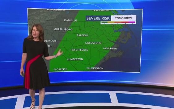
Portions of North Carolina are under a level 1 threat for severe weather on Wednesday and Thursday. This includes a threat for tornadoes, gusty winds, heavy rain and flooding.
Level 1 risk for severe weather
Much of the region, from the Triangle south, is under a level 1 risk for severe weather both Wednesday and Thursday. Severe weather and isolated tornadoes will be possible throughout the afternoon and evening.
Heavy rain, potential for flooding
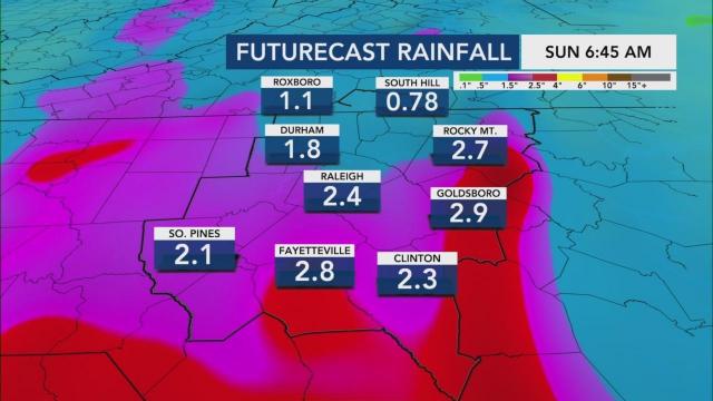
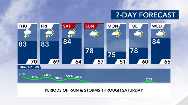
The rain is forecast to continue through Thursday, Friday and Saturday, tapering off early Sunday morning.
The rain will be on and off or scattered at times.
“Right now, rain totals from now through Sunday morning can range between 1 to 3 inches with some locally higher amounts up to 4 inches,” said WRAL meteorologist Elizabeth Gardner.
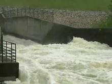
Some lakes are already at higher-than-average water levels, leaving a parking lot underwater and a boat ramp damaged. Waters at Falls Lake, Jordan Lake and Kerr Lake were high, with Kerr Lake 12 feet above normal before this system has even come through.
Saturated ground and wind gusts
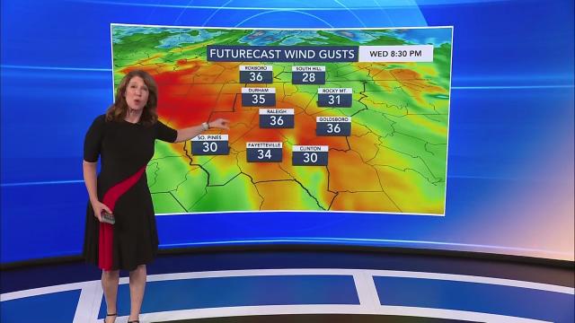
This system brings the potential for flooding, saturated ground and wind gusts up to nearly 40 mph. There is also a chance for tornadoes to form.
Tropical Depression Bertha
Bertha started off as a low pressure system and developed very quickly Wednesday morning thanks to warm ocean temperatures.
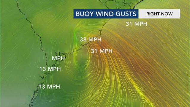
Areas near Charleston could see up to 2.5 inches of rainfall an hour from Bertha and damaging wind gusts as high as 65 mph.
Along America Street in Charleston, residents awoke Wednesday to an intersection that had become a water-filled canal. Cars parked on the curb had water up to their doors, local news outlets reported. Garbage cans had spilled over, and dirty diapers, magazines and food scraps clogged drains in the area.
Bertha weakened into a tropical depression Wednesday. “It will quickly become a low pressure system once it hits land, and it will affect a small area,” Gardner said. “The extent of this isn’t going to be widespread.”
Sunday will be a cooler, dry day. With highs in the 70s, it will feel mild compared to the rest of the week.
