- Seven months after Hurricane Helene, Chimney Rock rebuilds with resilience
- Wildfire in New Jersey Pine Barrens expected to grow before it’s contained, officials say
- Storm damage forces recovery efforts in Lancaster, Chester counties
- Evacuation orders lifted as fast-moving New Jersey wildfire burns
- Heartbreak for NC resident as wildfire reduces lifetime home to ashes
Houston Forecast: Tropical storm Cristobal forms
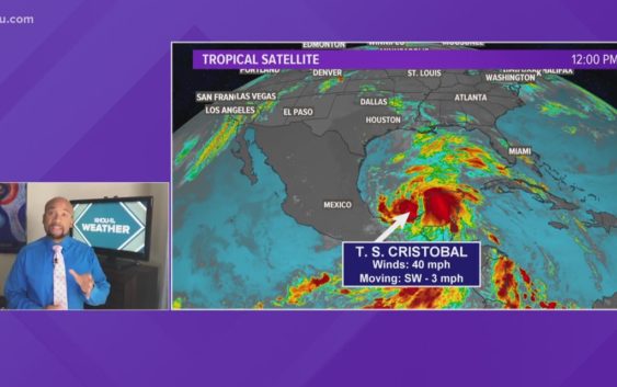
There’s still significant uncertainty regarding its track and intensity by the weekend. Spotty shower chances are with us today.
HOUSTON — Hurricane season started yesterday, and right on schedule, we had a brewing tropical system. By the afternoon hours yesterday, we had a tropical depression (TD#3) and then by the late morning hours today, we had Tropical Storm Cristobal. This is the earliest we have had the third name storm form on record, and records go back as early as 1851. We said this was going to be an active season.
Hurricane Hunters flew into Tropical Depression 3 earlier today and found max sustained winds at 40 mph which means that this system was officially a Tropical Storm. A tropical depression needs to have sustained winds of at least 39 mph to hit “tropical storm” status. If it strengthens to winds sustained of at least 74 mph, Cristobal would be upgraded to a hurricane.
It’s too early to tell exactly who will be at risk from this storm, so it is important everyone along the Gulf Coast pays close attention to the forecast this week.
I would urge you and your family to watch the weather with us twice a day, and use the KHOU 11 app to get updates on the go, just in case the system strengthens and decides to head our way.
GET ALERTS ON YOUR PHONE: Download the KHOU 11 app
TRACK THE WEATHER: Houston weather radar
If a system came Houston’s way, we could see higher tides and heavy rainfall and strong winds. But again, that’s only if something developed and came this way.
HOUSTON 7 DAY FORECAST