- David & Nicole Tepper increase Hurricane Helene relief commitment to $750k
- McDowell County wildfire spreads to 500 acres, evacuation orders in place
- Evacuations in Caldwell County due to wildfire
- Northwest Houston 'ghost neighborhood' caused by repeated flooding to become latest detention basin
- NHL playoffs: Hurricanes open playoffs Easter Sunday afternoon vs. Devils
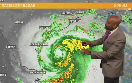
Houston Forecast: Hurricane Hanna weakening. More showers Sunday.

Scattered showers from distant Hanna feeder bands will continue into Sunday.
HOUSTON — The first hurricane of the 2020 Atlantic hurricane season has made landfall is likely a tropical storm by the time you read this.
Hanna was the first hurricane to strike Texas since Harvey in 2017 and the first hurricane to hit the state in the month of July since 2003. While July hurricanes in Texas aren’t unheard of, they’re not all that common either.
As the storm pulls away, it’ll take the bulk of the rain with it but will leave enough moisture behind to give us another round of showers and thunderstorms on Sunday. It won’t be a washout but it won’t totally dry either. We’ll call it a 60% chance Sunday and 50% chance Monday and Tuesday.
The ridge of high pressure that pushed the hurricane away from Houston is going to begin to pump up and expand over Texas. That means as we get into the middle of the coming week, rain chances go down and the temperatures start to go up.
Looking ahead to the month of August, which begins Saturday(!!!), things look to be close to seasonable norms with temps in the mid 90s and partly cloudy skies.
A quick side note: now that a hurricane has hit Texas, may that means it’ll snow this winter. There seems to be a tight correlation between hurricane strikes on Texas and snowfall in Houston. It’s happened too many times for it to be coincidence. Fingers crossed!
Tropics
The good news is Hanna is in the history books now. More good news: Tropical Storm Gonzalo has dissipated and is not coming back.
The bad news: there’s a new one brewing in the open Atlantic and this one has an 80% chance of developing into “Isaias.” We’ll need to keep an eye on this. Long range models indicate it **COULD** be a threat to the US in about 12 days.
LIVE HOUSTON AREA RADAR
GET ALERTS ON YOUR PHONE: Download the KHOU 11 app