- Seven months after Hurricane Helene, Chimney Rock rebuilds with resilience
- Wildfire in New Jersey Pine Barrens expected to grow before it’s contained, officials say
- Storm damage forces recovery efforts in Lancaster, Chester counties
- Evacuation orders lifted as fast-moving New Jersey wildfire burns
- Heartbreak for NC resident as wildfire reduces lifetime home to ashes
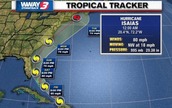
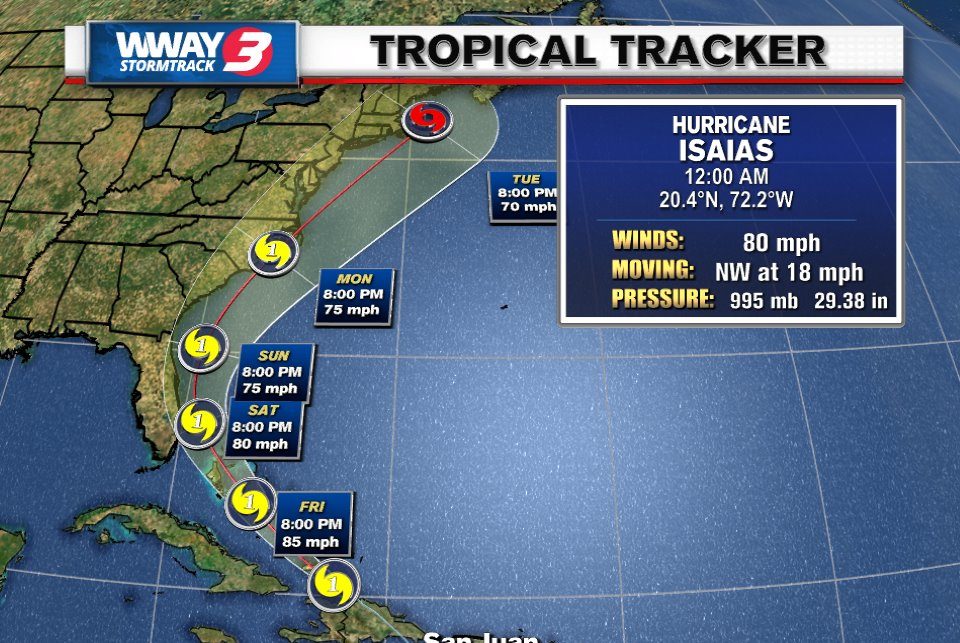
Isaias becomes the second hurricane of the 2020 season
Share on Facebook
Tweet on Twitter
WILMINGTON, NC (WWAY) — Tropical Storm Isaias knocked out power and caused flooding and small landslides across Puerto Rico and the Dominican Republic on Thursday and now has strengthened into a hurricane as it begins moving into the Bahamas while heading for the U.S. East Coast.
According to WWAY Chief Meteorologist Lee Haywood, an Air Force Hurricane Hunter Aircraft flying into Isaias has indicated the storm has strengthened to a hurricane as of 11:40 p.m. this evening with 80 mph winds.
The storm is centered 70 miles east/southeast of the Great Inagua Island.
Isaias is moving northwest around 18 mph. Minimum central pressure has dropped to 995 mb.
The government of the Bahamas has issued a hurricane warning for the central and southeast Bahamas.