- Sellers and Rantanen are among the NHL trade deadline winners. Hurricanes and Boeser are some losers
- Hurricane forecasters express concern over NOAA job cuts impact
- FEMA deadline for Hurricane Helene recovery aid extended again
- Tornado drills to take place at schools across North Carolina Friday morning
- Hays County emergency alerts cause confusion during Tuesday's wildfires
Isaias could generate flooding downpours in Northeast next week

After bringing torrential rain and damaging winds to the Bahamas and part of the Florida east coast this weekend, Isaias is likely to have some impact on the northeastern United States next week following a potential landfall in the Carolinas on Monday.
The ninth named storm of the 2020 Atlantic Tropical season, Isaias formed in the eastern Caribbean Sea on Wednesday evening. Northern islands of the Caribbean have been battered by heavy rainfall and strong winds, with the Bahamas and the southeastern U.S coast likely to feel the storm’s wrath next. Isaias strengthened to a Category 1 hurricane just north of Hispaniola during Thursday night and is forecast to tread through bath-like waters between Florida and the Bahamas this weekend.
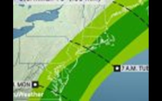
AccuWeather meteorologists expect Isaias to track along, just inland or just offshore of the mid-Atlantic and New England spanning Monday night to Wednesday. The exact track of the tropical system will determine the scope of the rain, intensity of the wind and the magnitude of the storm surge in the region.
Ahead of Isaias, rounds of wet weather will start to chip away at the drought conditions in the Northeast, thanks to a pattern change that will allow some Gulf of Mexico moisture to flow northward and Atlantic moisture to seep inland. Some of the driest areas so far this summer include portions of Maine down through New England into the Hudson Valley, as well as portions of central Pennsylvania and New York state.
Away from Isaias, several storms will follow the jet stream through the Northeast, allowing for waves of rain and thunderstorms from Saturday through early next week.
Not every location from Virginia to Maine will get wet weather through this entire timeframe, but most locations are likely to get at least a round or two of rain.
“Saturday looks unsettled and humid for mid-Atlantic cities like Washington, D.C., and Baltimore but still rather dry with more comfortable humidity levels from Pennsylvania on north,” said AccuWeather Senior Meteorologist Dave Dombek.
Dombek added that while it looks wetter in the rest of the Northeast on Sunday, forecasts currently don’t indicate that it would be an all-day washout. However, thunderstorms that erupt over parts of eastern New York state and western New England could be locally severe with high winds and perhaps an isolated tornado.
A front will move into the region on Monday, stalling late Monday into Tuesday near the Eastern Seaboard, putting it on a collision course with Isaias.
“Non-tropical systems, such as the one moving in from the Midwest, have drawn tropical storms and hurricanes close to and inland of the coast in the past, so there is still some risk of track along or just inland over the Northeast,” according to AccuWeather Senior Meteorologist Alex Sosnowski.
“Should this occur, heavy rain could be flung well inland of the coast and tropical storm to hurricane-force winds could occur along the coast from Virginia to Maine,” Sosnowski added.
However, the speed of either the front or Isaias could greatly impact what the forecast looks like in the coming days.
If Isaias were to speed up and reach the Northeast sooner, when steering winds are more southerly as opposed to westerly, it might bring enhanced rainfall farther inland. Should Isaias slow down or the front move a little faster, the greatest of Isaias’s impacts could remain offshore.
“Some of the rich tropical moisture associated with this storm is forecast to be pulled northward and interact with the stalled front regardless, resulting in a more enhanced period of showers and thunderstorms,” Dombek added.
The enhanced thunderstorms will have a higher chance of producing drenching downpours that could result in localized flooding problems.
The combination of a pattern change and any additional moisture from Isaias could bust the drought in part of the region before the end of the first week of August.
While the rain could be a benefit for the region, too much rain might trigger dangerous flash flooding.
“Should too much rain fall in the same place in a short period of time, the dry ground will struggle to absorb all the water it desperately needs,” said Dombek.
Low-lying and poor drainage areas will be the most susceptible to these flooding problems first.
“The heavy urban areas along the Interstate-95 corridor to the Atlantic coast, where there are a great deal of paved surfaces will stand the greatest chance of street and highway flooding in this situation,” Sosnowski said.
“If we get a situation where there is a strong tropical storm or minimal hurricane that hugs the mid-Atlantic and New England coasts, storm surge flooding could be a player for a brief time,” Sosnowski added.
The full moon is on Monday, and is a time of the month and roughly when astronomical tides are the highest. The arrival of Isaias will be a day or two later it appears and a worst-case scenario should be avoided.
Tides of 1-2 feet above normal are possible in this case, but are likely to be higher, perhaps 3-6 feet above normal in southeastern Virginia, where Isaias may be close by during Monday evening and storm surge flooding could be more significant in the region.
Keep checking back on AccuWeather.com and stay tuned to the AccuWeather Network on DirecTV, Frontier and Verizon Fios.