- Is your neighborhood at high wildfire risk? | Here's how to check the city's wildfire risk map
- 'Be prepared now': Brad Panovich updates severe weather risk for Sunday
- 'Be prepared now': Brad Panovich updates severe weather risk for Sunday
- As anxiety around wildfires grows, Austin plans to add tens of thousands of acres to risk map
- 'Not enough firefighters' | Rural fire departments in Central Texas get boost to help them fight wildfires
Afternoon summer showers, flash flooding possible Sunday

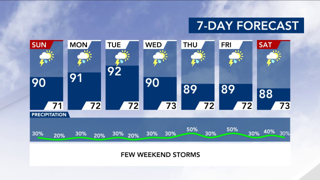
Sunday morning will start out warm and sunny. As the day heats up, it will feel between 91 and 93 degrees across the Triangle.
Expect storms sometime in the afternoon around lunchtime as it gets warmer, meteorologist Peta Sheerwood said.
“We are likely to see those afternoon summertime thunderstorms stick with us for the rest of the week,” she said.
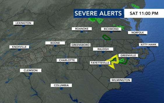
Overnight, Cumberland County saw some strong storms and lightning. Saturday night’s storms had winds with speeds as high as 45 mph around 4 a.m.
Around 2 inches of rain fell near Southern Pines and Whispering Pines. A flood advisory was put in place overnight and has since expired.
Even though that advisory has expired, flooding is still possible in areas south of Wake County.
As we head into the afternoon, those afternoon storms that are expected could bring flash flooding. The reason why is because we have a lot of moisture in the atmosphere and a stationary boundary that is parked overtop of North Carolina.
Storms will stay around from lunchtime and until 9 p.m. — like Saturday.
Not everyone will see the rain that is moving in Sunday afternoon — so Sheerwood said it’s best to still water your plants.
The front that is staying over our state will likely move out Monday. But, storms are still expected next week. This storm pattern is typical for summertime in North Carolina.
Tracking the tropics
There are a couple of disturbances in the tropics that WRAL’s weather team is monitoring but there is nothing that is immediately concerning.
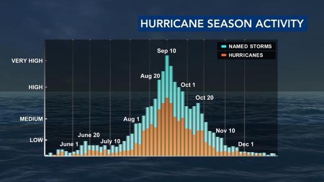
Atlantic Hurricane season has only just begun. The season is expected to peak early September with very high hurricane activity.

