- National memorial to honor NC firefighter who died on duty during Hurricane Helene
- Gov. Josh Stein extends State of Emergency for western NC wildfires
- Gov. Stein extends state of emergency for NC wildfire threat
- Governor Stein extends state of emergency for NC wildfire threat
- Governor Stein extends emergency in 34 NC counties amid wildfire threat
Is your home at risk of flooding? The Texas Flood Map and Tracker can tell you

-
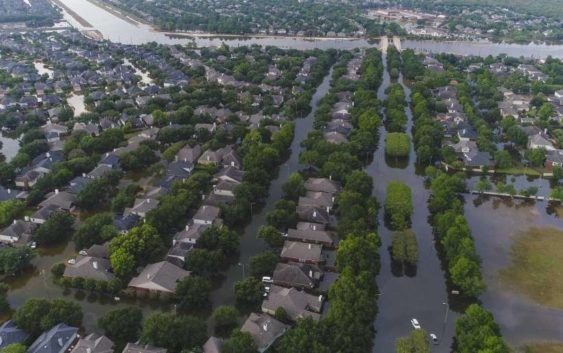
Homes in the Cinco Ranch area along S. Mason Road north of the Westpark Tollway are surrounded by water from Barker Reservoir, Saturday, September 2, 2017, in Houston.
Homes in the Cinco Ranch area along S. Mason Road north of the Westpark Tollway are surrounded by water from Barker Reservoir, Saturday, September 2, 2017, in Houston.
Photo: Mark Mulligan, Staff Photographer / Staff Photographer
Homes in the Cinco Ranch area along S. Mason Road north of the Westpark Tollway are surrounded by water from Barker Reservoir, Saturday, September 2, 2017, in Houston.
Homes in the Cinco Ranch area along S. Mason Road north of the Westpark Tollway are surrounded by water from Barker Reservoir, Saturday, September 2, 2017, in Houston.
Photo: Mark Mulligan, Staff Photographer / Staff Photographer
One of the tough realities of living in Houston is knowing floods are an unfortunate part of life.
But now, the Texas Flood Map and Tracker on HoustonChronicle.com can help you know what to expect.
The map shows long-term flood-risk data for areas across the state, as well as live updates on rainfall location and intensity, flooding alerts and street closures when storms come through the area.
CHECK THE WEATHER ON CHRON.COM

The Texas Flood Map and Tracker is a powerful interactive tool that allows Houston Chronicle subscribers to track rainfall location and intensity, updated flooding alerts and street closures during storms.
Risk data shows the likelihood of a property flooding in the next 30 years with data provided by FloodFactor.
Live weather updates are provided every 10 minutes with new information from RainViewer and the National Weather Service.
During significant weather events, users will also see National Weather Service flood warnings and National Hurricane Center storm surge predictions.
Houston Chronicle subscribers have unlimited access to the map.
“We are excited to add this vital and useful tool to the powerful journalism, podcasts and video already available to subscribers on HoustonChronicle.com,” Executive Editor Steve Riley said. “We’re confident our subscribers will find it helpful, and we encourage all readers to come take a look.”