- Seven months after Hurricane Helene, Chimney Rock rebuilds with resilience
- Wildfire in New Jersey Pine Barrens expected to grow before it’s contained, officials say
- Storm damage forces recovery efforts in Lancaster, Chester counties
- Evacuation orders lifted as fast-moving New Jersey wildfire burns
- Heartbreak for NC resident as wildfire reduces lifetime home to ashes
Tropical Storm Laura forms, expected to impact US next week

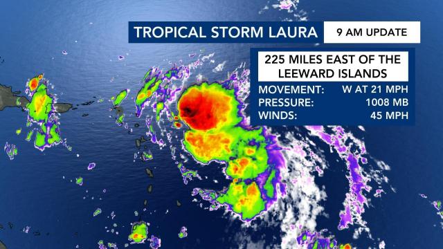
Tropical Storm Laura formed in the Atlantic Friday and is forecast to impact the United States as a hurricane early next week.
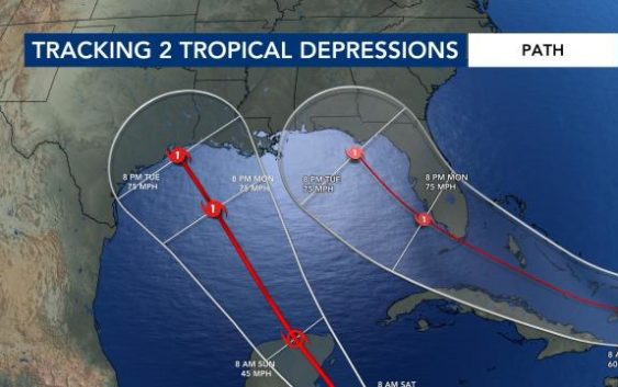
Tropical Depression 13 developed into Tropical Storm Laura by 9 a.m. It’s forecast to become a hurricane as it moves into the Gulf of Mexico in the coming days, and meteorologists say it could make landfall as a hurricane at around the same time as a second storm currently in the Caribbean.
WRAL meteorologist Elizabeth Gardner said Tropical Storm Laura and Tropical Depression 14 are developing at about the same pace and could make landfall within hours of each other late Tuesday and early Wednesday.
Tropical Depression 14 is expected to develop into Tropical Storm Marco by Friday evening.
The westernmost depression — Tropical Depression 14 — could impact the Yucatán Peninsula before making landfall in Texas Tuesday as a hurricane.
Tropical Storm Laura could eventually impact Florida’s panhandle as a hurricane by Tuesday or Wednesday.
“There’s certainly the possibility we could have one storm making landfall on Tuesday morning and another making landfall around Wednesday morning along the Gulf Coast in very close proximity,” said Gardner. “That’s something I can never remember happening.”
A third system near Africa will continue to move over the eastern Atlantic this week. There is a 40% chance of development within the next five days as it continues to move westward,
“I feel sure that it’s probably going to develop and this time of year you never know how many more are following right behind it,” said Gardner.
Peak hurricane season runs from mid-August to late October, and hurricane season officially ends on Nov. 30. WRAL meteorologist Elizabeth Gardner said very warm ocean temperatures are contributing to the active hurricane season.
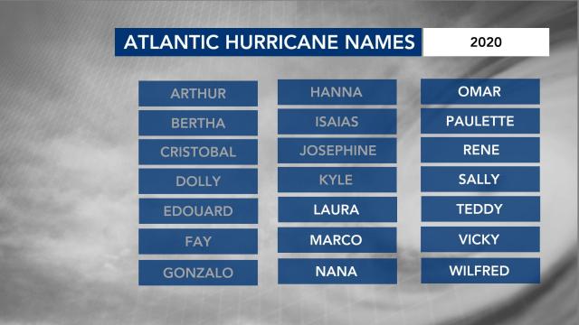
If all the names on the list of 2020 storm names are used before hurricane season ends, meteorologists will use Greek letters to refer to the storms.


