- Fake job seekers are flooding the market, thanks to AI
- One set of evacuation orders lifted in Caldwell County after wildfire contained
- 'We gutted every building' | Chimney Rock rebuilding after Hurricane Helene
- 'We gutted every building' | Chimney Rock rebuilding after Hurricane Helene
- Debris from Hurricane Helene provides fuel, complicates containment for spring wildfires
Marco expected to make landfall as tropical storm, Laura 48 hours later as a Cat. 2 hurricane
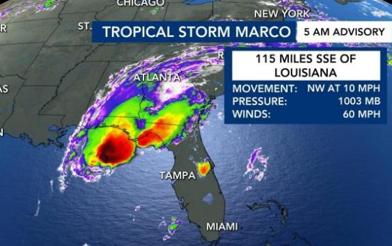
Two tropical systems are expected to make landfall along Louisiana’s coast hours about 48 apart this week, one as a Category 2 hurricane.
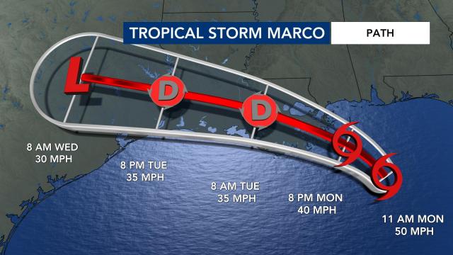
Tropical Storm Marco was briefly a hurricane but weakened overnight. At 11 a.m. Monday, Marco had maximum sustained winds of 50 mph and was moving north-northwest at 8 mph. WRAL meteorologist Elizabeth Gardner said it will likely remain a tropical storm as it moves northwest and brushes the Louisiana coast.
“Marco will track along the Gulf Coast states,” said WRAL meteorologist Aimee Wilmoth. “It will bring gusty winds and scattered storms today and tomorrow from Florida to Louisiana.”
Tropical Storm Laura will have a greater impact, she said.
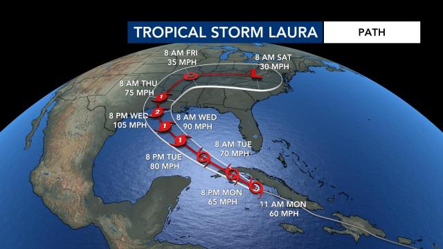
Unlike Marco, Tropical Storm Laura is expected to become a Category 2 hurricane before it reaches land. On Monday morning, Laura had maximum sustained winds of 60 mph and was moving west-northwest at 20 mph.
Since it will move through warm waters, it will gain strength and could make landfall near Louisiana and Texas Wednesday night, only 48 hours after Marco.
Coastal communities in those states could face storm surge, flooding and hurricane force winds on Wednesday and Thursday, Wilmoth said.
Gardner said the storms won’t impact Louisiana like Hurricane Katrina did in 2005, but the effects will be serious. Between 4 to 6 feet of storm surge is possible along Louisiana’s coast, and flash flooding is possible, with 3 to 6 inches of rain falling.
On Monday morning, Laura was bringing heavy rain to Cuba and Jamaica. At least “both storms will move quickly, so they’re not going to sit and dump a lot of rain,” Gardner said.
According to The Associated Press, officials fear a history-making onslaught of life-threatening winds and flooding along the coast, stretching from Texas to Alabama, as two storms affect the Gulf.
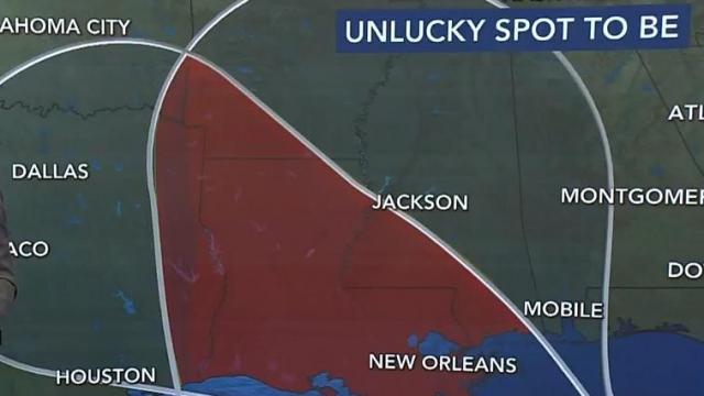
It’s rare for two storms to hit the Gulf in only a matter of days. Louisiana is in the “unlucky corridor” that is expected to take the greatest brunt of both storms.
Why the storms gain strength over the Gulf
Water temperatures in the Gulf of Mexico are warm, with temperatures in the mid-80s, which will likely cause each storm to strengthen as it heads towards landfall on the US coast.
“We expect it to gain more strength as it moves into the Gulf of Mexico,” WRAL meteorologist Peta Sheerwood said.
There is a “loop current” in the Gulf of Mexico, Sheerwood said.
Not only is the water warm in the Gulf, but it’s also very deep.
“Warm sea surface temperatures really help these storms fuel and intensify,” Sheerwood said.
As each storm rolls into the warm sea surface temperatures, it is expected to gain strength and be named as a hurricane, Sheerwood said.
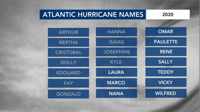
This year’s Atlantic hurricane season has been busy, with record-setting storms. Tropical Storm Marco was the earliest named M-storm in recorded history, according to WRAL meteorologist Mike Maze. If all the names on the list of 2020 storm names are used before hurricane season ends, meteorologists will use Greek letters to refer to the storms.
The Fujiwara Effect
States along the gulf are going to be severely impacted. When tropical systems get within 800 miles of each other, that is a phenomenon called the Fujiwara Effect.
“In this case … they would be about 400 miles apart and potentially as much as a day apart, but you can still see how close those centers are together,” meteorologist Elizabeth Gardner said on Friday.
If the storms remain at about equal strength, they would rotate around each other, she explained.
“But if, for some reason, Laura strengthens and we get potentially Marcos being stronger, then Marcos could absorb Laura and it could make a stronger storm,” Gardner said.
Tropical Storm Laura could eventually bring North Carolina rain sometime next week, but the timeline is not exactly clear yet.
A third system near Africa will continue to move over the eastern Atlantic this week.
Peak hurricane season runs from mid-August to late October, and hurricane season officially ends on Nov. 30. WRAL meteorologist Elizabeth Gardner said very warm ocean temperatures are contributing to the active hurricane season.
