- Seven months after Hurricane Helene, Chimney Rock rebuilds with resilience
- Wildfire in New Jersey Pine Barrens expected to grow before it’s contained, officials say
- Storm damage forces recovery efforts in Lancaster, Chester counties
- Evacuation orders lifted as fast-moving New Jersey wildfire burns
- Heartbreak for NC resident as wildfire reduces lifetime home to ashes
Rapid hurricane intensification: What is it and why is it important?
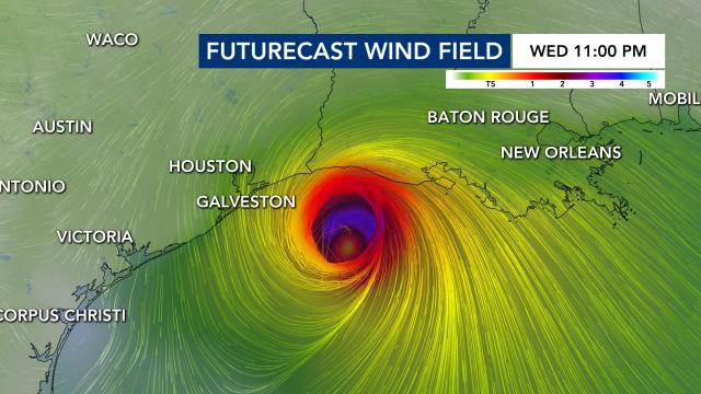
Hurricane Laura intensified rapidly Wednesday morning as it moved toward the Gulf Coast. The storm strengthened to Category 2 overnight and is expected to become a major Category 4 hurricane by Wednesday afternoon.
What is rapid intensification?
Rapid intensification is a phrase commonly used in August, September and October – the peak months of the Atlantic Hurricane season.
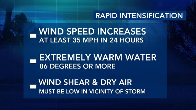
The National Hurricane Center defines rapid intensification as “an increase in the maximum sustained winds of a tropical cyclone (tropical depression, tropical storm or hurricane) of at least 35 mph in a 24-hour period.
Between 5 a.m. Tuesday and 5 a.m. Wednesday, Hurricane Laura saw a 45 mph increase in maximum sustained winds. Hurricane Laura is most definitely intensifying rapidly and is forecast to continue intensifying up until landfall overnight tonight.
Unfortunately, rapid intensification is nothing new. Notable hurricanes like Dorian (2019), Michael (2018) and Harvey (2017) all strengthened rapidly in the days before making landfall.
Why is Laura intensifying rapidly?
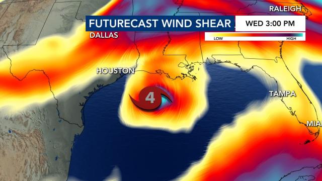
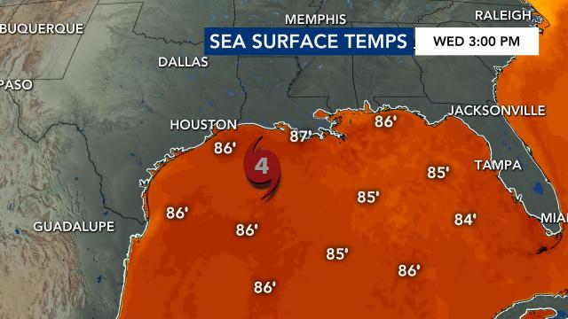
Hurricane Laura is currently in an environment conducive for rapid intensification with low wind shear (low wind speeds with height around the hurricane), abundant tropical moisture and warm water temperatures.
In the image below, you may see some colors denoting wind shear around Hurricane Laura, but because Laura is so strong and tall in the atmosphere our models are picking up on the storm itself while the higher wind shear values are just towards the north of the hurricane.
How can we tell if Hurricane Laura is intensifying rapidly?
DeMaria et al. (2012) found that lightning observations can provide information about hurricane updraft strength, which signifies hurricane intensity.
Black and Hallett (1999) surveyed reports of electrical activity from a large sample of aircraft flights into tropical cyclones. Their results indicated that tropical cyclone lightning within 100 km of the storm center was somewhat rare and was usually associated with fairly strong updrafts (>10 m s−1).
Although updrafts of 25 m s−1 have been observed by aircraft (Black et al. 1994), the typical values in tropical cyclones are usually much weaker. For example, Jorgensen et al. (1985) showed that the 90th percentile of hurricane eyewall updraft speed was only about 4 m s−1.
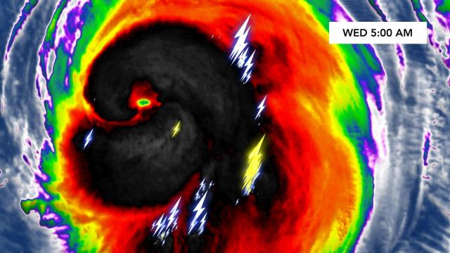
At 5 a.m. Wednesday, lightning could be seen in not only the rainbands of Hurricane Laura but even closer to the center of Laura’s circulation.
Lightning density in the rainband regions is higher for cyclones that rapidly intensified in the following 24 hours (DeMaria et al. 2011).
With the previous statement in mind, the lightning currently present in Hurricane Laura’s rainbands is why the National Hurricane Center is forecasting Laura to continue strengthening – potentially becoming a Category 4 Hurricane before landfall overnight tonight. The European Model shows that scenario late tonight just offshore of Texas and Louisiana.
Hurricane Laura is and continues to become a very dangerous storm. You can track Hurricane Laura anytime with the interactive hurricane tracker or tune in to WRAL News for the very latest.
