- Hays County emergency alerts cause confusion during Tuesday's wildfires
- Tuesday's wildfires scorched more than 500 acres in south Bexar County
- How big were this week's wildfires in Bexar County?
- Crews contain wildfire in southeast Williamson County
- Wildfire contained to 300 acres in northwest Matagorda County
Hurricane Laura weakens to Category 1 storm; still tracking north across Louisiana

As of 11 a.m. EST, the National Hurricane Center reported Laura had maximum sustained winds of 85 miles per hour, making it a Category 1 storm.
Laura is moving north at 15 mph, a brisk pace and good news for keeping rain totals down. The eye is about 65 miles south-southeast of Shreveport, Louisiana.
WATCH: Damage caused by Laura during landfall
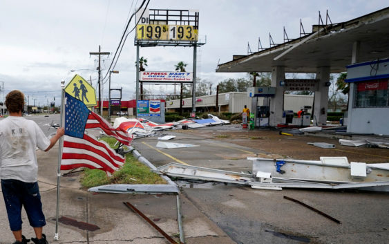
The National Hurricane Center said the storm made landfall near Cameron, Louisiana, around 2 a.m. It was a Category 4 storm with maximum sustained winds of 150 mph (240 kph), making it the most powerful hurricane to strike the U.S. so far this year.
The storm’s power has raised fears of a 20-foot (6-meter) storm surge that forecasters say would be “unsurvivable” and capable of sinking entire communities on the Texas and Louisiana coast. The surge could penetrate up to 40 miles inland from the coastline.
Hundreds of thousands of homes and businesses are without power in Louisiana and Texas. Some of those communities could be without power for weeks, according to local officials.
Hurricane-force winds are expected to continue throughout the morning.
Hurricane categories: Learn what the numbers mean
Laura is already being blamed for 11 deaths. All of those happened in the Dominican Republic and Haiti, where the storm knocked out power and caused major flooding.
In Texas and Louisiana, the extent of the damage remains unknown as the sun has not yet risen and the storm continues to batter the area.
Laura is expected to eventually weaken to a post-tropical depression and work its way through the Ohio River Valley. It could eventually race east across Tennessee, Virginia and North Carolina, dumping heavy rain along its way.
WATCH: What is the Saffir-Simpson scale for hurricanes
Copyright © 2020 WTVD-TV. All Rights Reserved.