- David & Nicole Tepper increase Hurricane Helene relief commitment to $750k
- McDowell County wildfire spreads to 500 acres, evacuation orders in place
- Evacuations in Caldwell County due to wildfire
- Northwest Houston 'ghost neighborhood' caused by repeated flooding to become latest detention basin
- NHL playoffs: Hurricanes open playoffs Easter Sunday afternoon vs. Devils
See photos, videos of Hurricane Laura damage in Texas
CLOSE
As winds from Hurricane Laura increase in southeast Texas, Greg Becker takes wind measurements in Port Arthur. USA TODAY
Hurricane Laura made landfall early Thursday morning near Cameron, Louisiana, as a powerful Category 4 storm.
The storm is expected to continue to dump 8-12 inches of rain from far southwest Louisiana and the Golden Triangle of Southeast Texas with isolated totals of 18 inches. About 5-10 inches with isolated totals of 15 inches are also expected across central and the rest of western Louisiana into far eastern Texas, according to the National Weather Service.
Thursday Laura updates: ‘Catastrophic’ storm surge, flooding, high winds across coast
Rapid weakening is forecast, and Laura is expected to become a tropical storm later today.
Residents were warned that catastrophic storm surge, hurricane-force winds and flash flooding will continue through the morning.
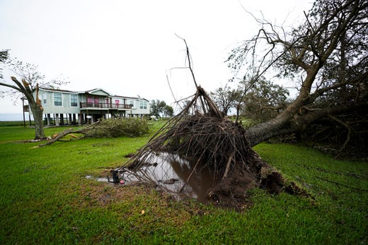
Here’s what conditions look like Thursday morning:
Port Arthur, TX
Hurricane Laura damage: See aftermath from the storm in south Texas


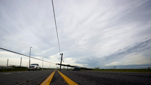


Orange County, Texas
Read or Share this story: https://www.caller.com/story/news/2020/08/27/hurricane-laura-aftermath-damage-photos-videos-texas-thursday-morning/3435571001/