- At least 4 dead, hundreds rescued after deadly floods ravage South Texas
- Today on Texas Standard: Deadly floods swamp South Texas, shatter records
- North Carolina radio station was a critical lifeline after Hurricane Helene. Then it became the voice of recovery.
- As storms approach, Rock Hill residents look back on last April's devastating hailstorm
- As storms approach, Rock Hill residents look back on last April's devastating hailstorm
Remnants of Sally moving out of area; Flash flood watch in effect through Friday
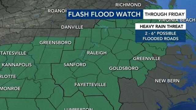
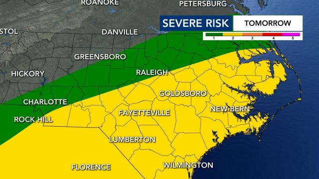
Much of North Carolina was under a flash flood watch and a Level 2 risk for severe storms on Thursday and into Friday evening.
The rainy conditions we’ve seen across the Triangle on Thursday were lessening into the night along with the threat for possible tornadoes. The Tornado Watch for counties south of the Triangle has been canceled as of 8:30 p.m.
Areas around central North Carolina have received an abundance of rain but no threats of flooding have been seen through late Thursday evening. Places like Lake Gaston (2.79 inches of rain in the past 24 hours), Pinehurst (2.5 inches) and Warrenton (2.72) have registered the most amounts of rain in the central N.C. region.
Flash flood watches were canceled for Cumberland, Hoke, Harnett, Moore, Sampson and Lee counties around 9:15 p.m. Thursday. Many areas were still in the watch, including Wake and surrounding counties, through at least Friday.
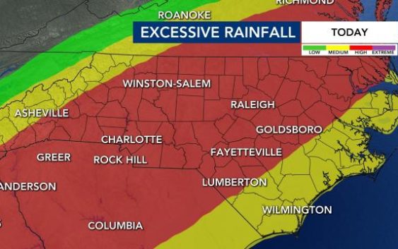
Remnants from Sally were bringing excessive rainfall and some minor flooding to the region.
Earlier this month, two young children riding in their mother’s car in Smithfield died when the car was swept away in floodwaters. Eight inches of rain was reported in the area. Their bodies were found days later in a shallow creek near the Neuse River.
Sally has been downgraded to a tropical depression. The storm made landfall in Alabama at around 6 a.m. on Wednesday as a Category 2 storm. The remains of Sally will cause a remnant low south of North Carolina.
Heavy rains and saturated ground trees could come down and power outages are possible on Thursday and Friday. Wind gusts are expected to pick up to 20 to 30 mph, which could also knock over trees.
Flooding risk
WRAL meteorologist Elizabeth Gardner said the number one risk for Thursday is flooding.
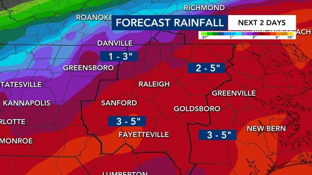
The Triangle is expecting 2 to 5 inches in the next two days from these storms.
“There are going to be places that don’t see flooding and there are going to be places that do,” said Gardner.
Minor river flooding is also forecast for several area rivers.
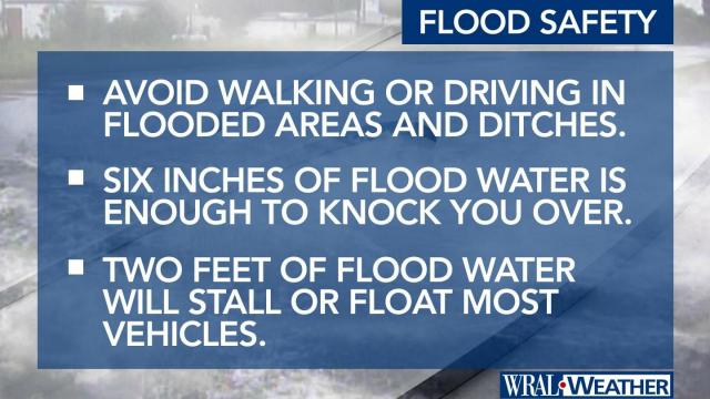
City of Raleigh officials said that flooding is possible on the Capital Area Greenway System. Officials said to not attempt to cross flood waters covering any part of the Greenway.
Slowdown if you come across asphalt, concrete or wooden bridges that are flooded.
The flash flood watch expires at 11 a.m. on Friday.
Level 2 risk for severe weather
The highest risk for severe weather is under the center of circulation.
Storms rolling in on Thursday could cause damaging wind gusts from faster moving bands of rain and tropical downbursts. There is also the chance of a weak tornado or two. The chance for tornados is low, according to WRAL meteorologist Zach Maloch.
Thunderstorms should move out of our area by Friday night.
NC prepares for storms
Wake County’s free coronavirus testing site at the Sunnybrook parking deck will close at noon on Thursday ahead of storms.
Anyone who has a scheduled appointment can come back at any time on Friday to get tested for the coronavirus.
Governor Roy Cooper will talk about the soaking rain and flooding risks North Carolina is facing in a press conference on Thursday at 3 p.m.
The state already had national guardsmen and swift water rescue teams on standby.
