- $37M drainage improvement project designed to combat flooding in NE Harris County
- Temporary bridges in Avery County at risk due to severe weather threat
- FEMA extends aid as Hurricane Helene recovery efforts surpass $360M
- Nearly every North Carolina wildfire caused by people, researchers say
- Weather IQ: How do wildfires ignite?
Damaging winds and hail possible for Monday's severe weather risk
Raleigh, N.C. — It’s been a dry spring so far, but we could finally see some rain this week, starting on Monday.
“This is going to kick off a much more unsettled weather pattern,” said WRAL meteorologist Elizabeth Gardner. “We’re going to have a better chance for rain.”
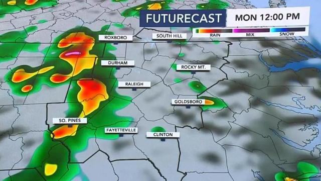
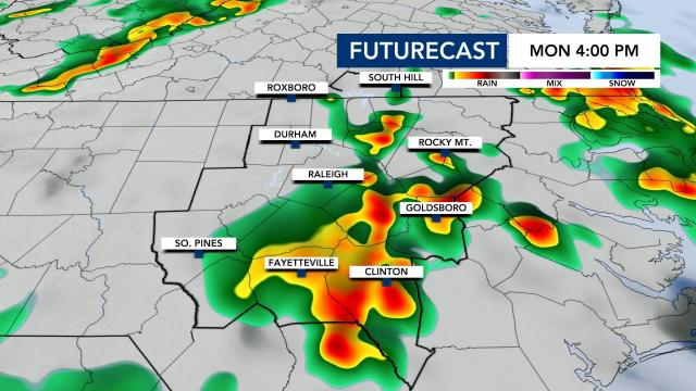
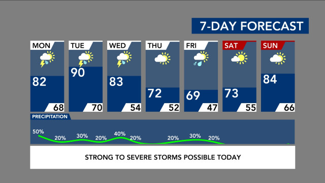
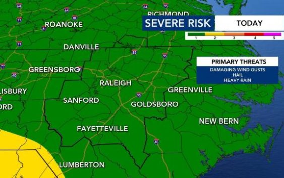
The best chance for rain on Monday will be midday through the afternoon. Some of Monday’s storms could become strong to severe with the biggest potential being damaging winds.
“We get into that daytime heating and that tends to destabilize the atmosphere even more,” Gardner said.
Most of central North Carolina is under a Level 1 risk for severe weather on Monday. Hoke and Moore counties were previously under a Level 2 threat, but that has since expired.
The same system that has wreaked havoc across the deep south is coming our way, although it won’t be as severe. There were dozens of tornado reports across Mississippi on Sunday.
As of noon, a fast-moving line of storms was approaching the Triangle, Thunderstorms will start popping up and continue through the early evening hours.
“There could also be some small hail,” said WRAL meteorologist Zach Maloch.
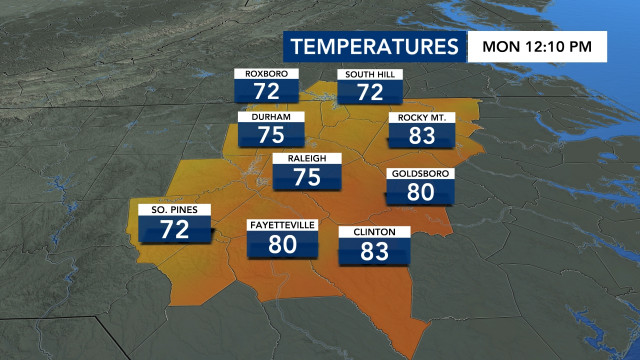
Highs on Monday will be in the low 80s.
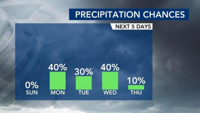
Tuesday and Wednesday will also have rain chances, primarily in the afternoon. Tuesday’s high will be around 90.
“The mornings could see a few small showers,” said Maloch.
Currently, there is not a risk for severe weather on Wednesday, but that could change based on a cold front moving through the area. Wednesday carries a forecasted high of 83.
Thursday will be drier, but it won’t last long.
Again, rain chances will be back on Friday.
“A quick-moving system will bring some showers our way by Friday,” said Maloch. “We could see a few early morning showers but the better rain chance arrives Friday afternoon and evening.”
Central North Carolina is abnormally dry, so we do need the rain. Rain totals over the next 5 days will be hit-or-miss.
“In all, we could see upwards of an inch of rain with everyone getting a bit here and there,” said Maloch.
The good news is that the weekend looks drier, according to Maloch.
