- David & Nicole Tepper increase Hurricane Helene relief commitment to $750k
- David & Nicole Tepper increase Hurricane Helene relief commitment to $750k
- McDowell County wildfire spreads to 500 acres, evacuation orders in place
- Evacuations in Caldwell County due to wildfire
- Northwest Houston 'ghost neighborhood' caused by repeated flooding to become latest detention basin
Chance of heavy rain, flooding continues in San Antonio through weekend
We know you’re tired of the rain, San Antonio, but there’s good news … and bad news.
The good news is that the overall risk of severe storms in the area on Thursday remains low, which means that San Antonio is less likely to see aggressive thunderstorms – or have to deal with the effects of the more turbulent weather.
The bad news is that San Antonio is still expected to see heavy rainfall and could see rainstorms through Saturday.
While severe storms are expected to shake up the Hill Country Thursday morning, San Antonio can expect to see between half an inch and an inch of rainfall in the coming days, according to the National Weather Service.
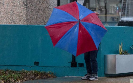
A person struggles with their umbrella as the rain falls in downtown San Antonio.
Jessica Phelps, Staff photographer / San Antonio Express-NewsRELATED: Locals are tired of the storms, but there’s more rain on the way to San Antonio
As the storms move into the I-35 corridor, isolated pockets of up to four inches are possible in San Antonio, as is pea-size hail if stronger storms occur. With the heavy rainfall, there is a possibility of flash flooding or flooding in areas such as rivers or creeks.
NWS predicts that San Antonio will see rounds of showers and storms through Saturday, with the chances of storms peaking on Friday and Saturday, at which point the storms are expected to shift east.
Read more from Sarah