- Dangerous travel conditions: Ice, snow and flooding possible
- How photos lost in disasters like Hurricane Helene find their way home, with a little help from people who care
- Dangerous travel conditions, ice/snow and flooding possible in the mountains Tuesday and Wednesday
- Weather Impact Alert: Dangerous travel conditions, ice/snow and flooding possible in the mountains Tuesday and Wednesday
- North Carolinians perplexed by unexpected DMV refunds tied to Hurricane Helene relief
Tropical Storm Elsa: Latest projected path, models and potential impact to Florida

A Tropical Storm Warning has been issued for a portion of the Lesser Antilles. Impacts, if any, to Florida are still unclear. Stay tuned for updates.
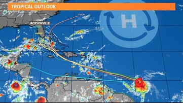
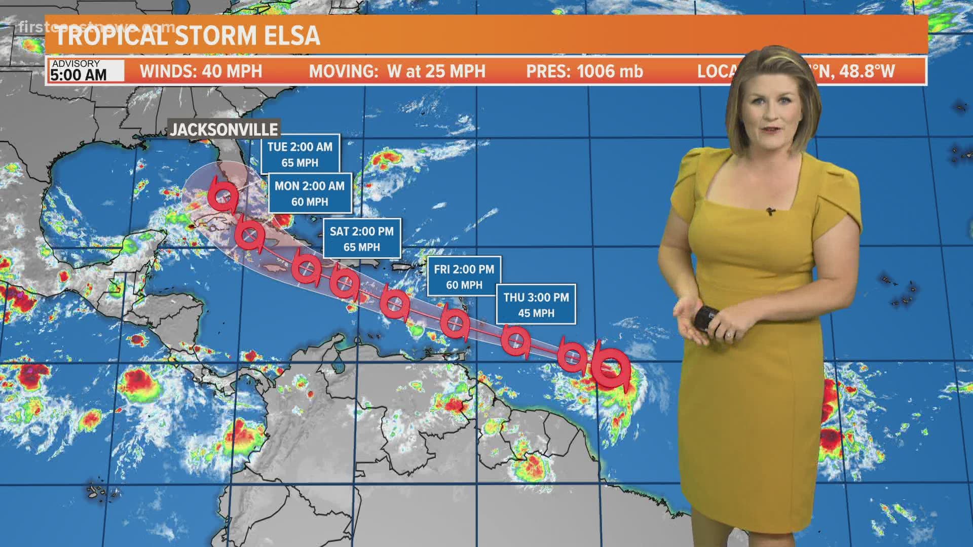
JACKSONVILLE, Fla. — Tropical Depression Five has formed into Tropical Storm Elsa as of early Thursday morning. Impacts, if any, to the state of Florida or the United States, are still unclear. There remains a great deal of uncertainty of the intensity and track forecast in the long range.
Make sure to check in every day or so for updates. We will be watching this system as it heads into the Caribbean by Friday and toward the Greater Antilles early next week.
Elsa is the earliest-known fifth named storm on record for the Atlantic basin in the satellite era (1966-present), breaking the record formerly held by Edouard on July 6, 2020.
As of 8 a.m. on Thursday: Elsa’s center was located about 780 miles east-southeast of the Windward Islands with maximum sustained winds of 40 mph. A Tropical Storm Warning is in effect for Barbados, Martinique, St. Lucia, St. Vincent and the Grenadines.
Tropical Storm Elsa

KEY MESSAGES:
- Tropical storm conditions are expected to begin early Friday in portions of the Windward and the southern Leeward Islands.
- Heavy rainfall from the system will move quickly across the Windward and the southern Leeward Islands, including Barbados, on Friday. Isolated flash flooding and mudslides are possible.
- There is a risk of wind and rainfall impacts in portions of the Virgin Islands, Puerto Rico, Hispaniola, Cuba, the Turks and Caicos, and the southeastern Bahamas through early next week. Interests in these areas should monitor the system’s progress and updates to the forecast.
- Interests in Florida should monitor updates to the forecast for this system, but it is too soon to determine what if any impacts could occur there next week given the uncertainty in the long-range forecast.
Hurricane season is already here and it’s time to be prepared if you aren’t already. Make sure you have had conversations with your loved ones about what you would do if a storm were to threaten.
This year, NOAA released the new seasonal averages for the Atlantic basin. According to the 30-year data from 1991 to 2020, the new averages include 14 named storms, 7 hurricanes, and 3 major hurricanes. The previous Atlantic storm averages, based on the period from 1981 to 2010, were 12 named storms, 6 hurricanes, and 3 major hurricanes. The averages from 1951-1980 , were 11 named storms, 5 hurricanes, and 1 major.
Hurricane safety and preparedness are critically important before the season begins on June 1. NOAA’s National Weather Service provides resources to prepare for hurricane hazards and real-time updates about active weather systems from the National Hurricane Center at www.hurricanes.gov.
The Atlantic hurricane season officially runs from June 1 to November 30.
Download the First Coast News app and sign up for severe weather alerts
