- Caught on camera | Tornado touches down in Missouri
- Carolina Hurricanes playoff tickets go on sale next week
- Storms kill 6 in the South and Midwest as forecasters warn of catastrophic rains, floods this week
- Weather Impact Alert: Cold front could trigger severe weather in Houston area this weekend | See timeline
- Violent storms cut through the South and Midwest, spawning tornadoes and killing 3
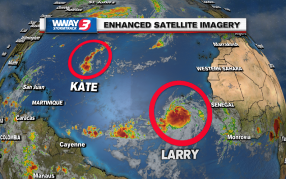
Ida’s not done, Kate persists, Tropical Storm Larry forms

MIAMI (AP) — The remnants of Hurricane Ida were forecast to dump rain from the central Appalachians into New England on Wednesday, with up to 8 inches (20 centimeters) possible in spots from Pennsylvania to Massachusetts. Kate persisted as a tropical depression far from Atlantic coasts, and Larry became a tropical storm off the coast of Africa.
Ida remains a tropical depression, and the National Hurricane Center said its top sustained winds of 30 miles (48 kph) were forecast to strengthen through Wednesday night. “Tornadoes are probable” across parts of the mid-Atlantic states during the afternoon and evening hours,” forecasters warned, issuing a tornado watch along the Appalachians through western Virginia and northern North Carolina.
The forecast also warned of significant and life-threatening flash flooding, especially in cities and areas of steep terrain, and major river flooding was predicted from northern West Virginia through New Jersey, particularly in the Monongahela, Potomac, Susquehanna, Delaware, and lower Hudson river basins.
“Tenacious Compact Kate” was “still holding on” in the central Atlantic, the hurricane center said, while Tropical Storm Larry formed south of the Cape Verde Islands and was forecast to become a hurricane by late Thursday or Friday.