- NWS: 5 tornadoes touched down in Houston area on day after Christmas
- Weather Aware: Heavy rain, gusty winds and isolated tornadoes across the Carolinas Sunday
- Postal worker unharmed as tornado briefly touches down, flipping truck in Houston
- Damage to homes, flipped USPS mail truck in SW Houston caused by tornado, National Weather Service says
- Nonprofit delivers homes to families affected by Hurricane Helene
Panovich: Low risk of severe weather Wednesday evening

Wednesday will be the last day of wet weather in the Charlotte region before a dry and pleasant start to fall with temperatures in the 70s.
CHARLOTTE, N.C. — Wednesday is the first day of fall and Mother Nature will bring another round of rain to the Carolinas with the threat of severe weather and storms.
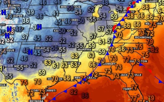
First Warn chief meteorologist Brad Panovich said the first real cold front of fall is moving in and with is the threat for thunderstorms. The good news is the threat for severe weather is low and it’s not widespread across the Charlotte region.
“There’s a small risk for severe storms this afternoon and evening, but the overall risk is really low,” Panovich said. “There’s a very small chance for an isolated tornado along this front.”
Panovich said if the clouds and showers don’t move out during the day, the risk is even lower. Without sunshine, even just an hour or two, there won’t be much energy for thunderstorms to strengthen.
By 3 p.m., the first band will move into the mountains. There isn’t much risk there due to thick cloud cover. East of the mountains, particularly east of Interstate 77, is where Panovich is most concerned.
“Areas east of I-77 we’ll be watching. We’re talking Concord to Salisbury, Albemarle and north along I-85,” Panovich said.
Panovich said the timing for these storms will likely be in the early evening, from 6 p.m. until 8 or 9 p.m. The storms won’t be severe in the middle of the day or overnight, so by dinner time Wednesday, everyone should be in the clear.
By 1 a.m., the storms will be gone and it’s going to definitely feel like fall.
“It’s going to feel amazing around here,” Panovich said.
The heaviest rain will likely be east of Charlotte, with some lingering storms in parts of Albemarle, Ansonville, and Wadesboro, along Highway 52.
Projected rainfall totals Wednesday:
- Boone: 0.28″
- Charlotte: 0.30″
- Cheraw: 1.15″
- Concord: 1.11″
- Rock Hill: 0.71″
- Salisbury: 0.70″
Wednesday afternoon’s high will be around 80 degrees. The rest of the week will see highs in the mid-to-upper 70s and bright, Carolina blue skies.
Contact Larry Sprinkle at lsprinkle@wcnc.com and follow him on Facebook, Twitter and Instagram.
Wake Up Charlotte To Go is a daily news and weather podcast you can listen to so you can start your day with the team at Wake Up Charlotte.
SUBSCRIBE: Apple Podcasts || Spotify || Stitcher || TuneIn || Google Podcasts
All of WCNC Charlotte’s podcasts are free and available for both streaming and download. You can listen now on Android, iPhone, Amazon, and other internet-connected devices. Join us from North Carolina, South Carolina, or on the go anywhere.