- As wildfires grip South Carolina, governor warns: Burn and you’ll go to jail
- Hundreds of brush fires burn across North Carolina Saturday; several fires still burning Sunday
- Texas’ biggest wildfire started a year ago. How does the Panhandle look now?
- To her, Hurricane Helene debris isn’t trash. It is full of memories — and she’s returning them
- Bills introduced a year after state’s largest blaze seek to limit wildfires
Strong line of storms brings Level 2 risk for severe weather Wednesday
Raleigh, N.C. — A line of strong storms impacting the Deep South is approaching North Carolina.
The storms left widespread damage in Texas on Monday and drifted into Louisiana, Mississippi and Alabama on Tuesday, where there was a rare Level 4 risk for some areas. WRAL meteorologist Elizabeth Gardner said the threat will be lessened by the time the storms reach our area.
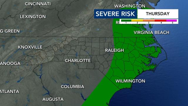
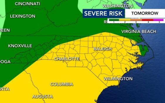
Almost all of central and eastern North Carolina is under a Level 2 risk for severe weather beginning Wednesday night, when storms are expected to arrive. There is a low risk for tornadoes and hail, but isolated flooding and wind damage will be likely, and up to 1 inch of rain could fall. At this point, the risk looks to be in effect through Thursday morning.
“It’s beginning to look like an overnight Wednesday, early Thursday morning event for us,” said Gardner.
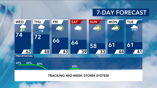
Before the storms, Tuesday will be a dry, cloudy day, with a high in the low to mid 70s. Wednesday, which will be a mostly dry day, will be even warmer before the storms move in overnight.
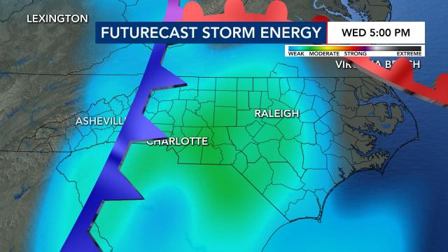
“We see a warm front lifting northward with a chance of a shower along that warm front,” Gardner said of Wednesday. “Once we get into the evening after all that daytime heating, we might fire up a shower or a thunderstorm and one or two of those could reach severe criteria.”
The severity of the storms largely depends on when they move into the area, Gardner explained. If the storms move in earlier in the evening, when the heat from the day is still present, there will be more energy for the storms. Wednesday’s storms are expected to arrive overnight, when it is cooler, so there will be less energy and a lessened risk.
The tornado threat is significant across the deep south, but WRAL meteorologist Aimee Wilmoth said our chances for tornadoes are low with wind gusts and localized flooding being the bigger threats.
The storms should move away Thursday morning, but a Level 1 low risk goes into effect for eastern North Carolina, where wind damage is possible. There could be some lingering rain throughout the afternoon, but the storm risk is largely overnight.
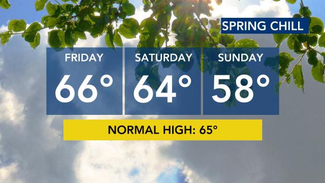
Temperatures will be cooler, in the 60s, for Friday and Saturday. On Sunday, highs will be in the upper 50s. The weekend should be clear, and we could be close to freezing Monday morning, when lows drop into the lower 30s.
Eager to get the garden going?
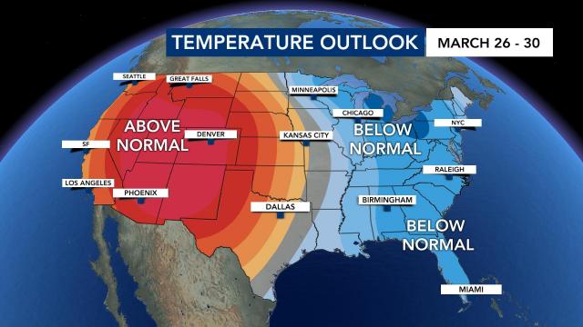
Wondering if it’s okay to start planting? Temperatures will stay spring-like for a while, but cooler temperatures are ahead. We’re expecting cooler than average temperatures next week, according to meteorologists.
Our average last freeze comes in mid-April.
