- Texas’ biggest wildfire started a year ago. How does the Panhandle look now?
- To her, Hurricane Helene debris isn’t trash. It is full of memories — and she’s returning them
- Bills introduced a year after state’s largest blaze seek to limit wildfires
- A year after Texas’ largest wildfire, Panhandle residents tugged between hope and anxiety
- Another $500M for Hurricane Helene relief in North Carolina passes key hurdle
Why could something called La Niña help hurricanes this year?
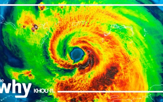
The National Oceanic and Atmospheric Administration says La Niña conditions are expected to persist through this hurricane season. And while we are talking about the Atlantic hurricane season, it’s conditions out in the Pacific that can affect the severity.
A cycle of climate patterns off the coast of Peru shift back and forth every two to seven years alternating between El Niño and La Niña.
During El Niño, ocean temperatures in the Pacific are warmer than normal. During La Niña, water temperatures are cooler than normal. During El Niño, higher wind shear is more likely over the Caribbean which can be disruptive to hurricane development.
During La Niña, the opposite happens, meaning the environment can be more favorable for storms to grow.
And La Niña does more than just help hurricanes. It is a factor in creating more severe weather and tornadoes in the southeastern U.S. It also is blamed for less rain and snow in the west and south. That is not good news for an area already dealing with drought.