- Fake job seekers are flooding the market, thanks to AI
- One set of evacuation orders lifted in Caldwell County after wildfire contained
- 'We gutted every building' | Chimney Rock rebuilding after Hurricane Helene
- 'We gutted every building' | Chimney Rock rebuilding after Hurricane Helene
- Debris from Hurricane Helene provides fuel, complicates containment for spring wildfires
Hurricane Ian will bring big waves, dangerous rip currents along Texas Gulf Coast

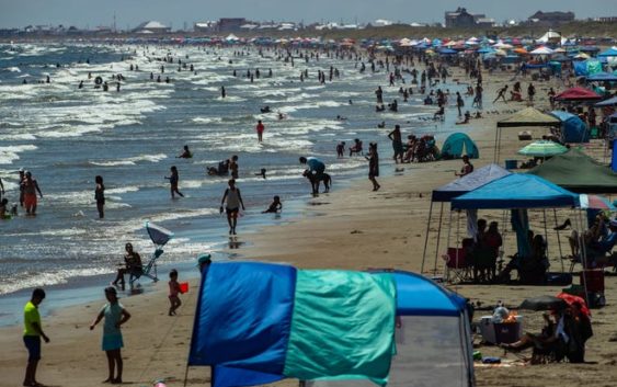
Those planning to hit the beach this week should watch out for longer swells, large waves and strong rip currents as Hurricane Ian moves into the southeastern Gulf of Mexico.
Hurricane Ian strengthened into a major hurricane Monday night as it continued its path to Florida’s Gulf Coast. The storm will bring increased risks for coastal flooding and rip currents through much of the week, according to the National Weather Service in Corpus Christi.
Hurricane Ian marks the first tropical system to affect the Coastal Bend over the current hurricane season.
“It’s a fairly large and strong storm that’s going to push all of that water towards our area, pushing up all that water and increasing wave heights,” meteorologist Brian Field said.
Field said longer swell periods and waves up to 12 feet will increase wave runup onto area beaches, contributing to moderate coastal flooding.
“Water is definitely going to reach the dunes and may even flood low-lying roads and areas on the coast,” Field said. “If we’re looking at the effects, we could start seeing those (Tuesday night) and through the weekend because it may take a while for the swells to subside.”
Extra signage including the city’s beach flag warning system and message boards with beach conditions will be posted, and the city will have additional lifeguards on duty at city beaches, according to Corpus Christi Parks and Recreation Director Robert Dodd.
“Gulf beaches and flooding is going to be dangerous conditions,” Dodd said. “With the extremely rough surf, the high tide is going to be up to the dunes. We’re not getting the actual hurricane, but we’re getting the remnants of it.”
With waves as high as 8 to 12 feet, coastal flooding could force the closure of beach access roads to vehicle traffic.
“Residents will be allowed to park along the access road and walk to the beach if they feel they need to go out there,” Dodd said.
The Padre Island National Seashore closed its beaches to traffic Monday evening in anticipation of increased wave heights and coastal flooding. The beaches will be reopening once they are determined safe for driving, a post from the park stated.
The area will be mostly dry over the next week, according to the National Weather Service. Temperatures will remain in the upper 80s to low 90s during the day and in the 60s at night.
More news:
More:Let these Corpus Christi haunted houses give you a scare in 2022
More:Nueces County creates TIRZ for proposed Tesla lithium refinery. Here’s what that means.
More:Hurricane season 2022: Here’s everything you’ll need to be prepared in South Texas