- McDowell County wildfire spreads to 500 acres, evacuation orders in place
- Evacuations in Caldwell County due to wildfire
- Northwest Houston 'ghost neighborhood' caused by repeated flooding to become latest detention basin
- NHL playoffs: Hurricanes open playoffs Easter Sunday afternoon vs. Devils
- 2 wildfires spreading in rugged terrain in western North Carolina
Heavy winds, tornadoes, hail forecasted for San Antonio, Hill Country

NWS says the weather will arrive Thursday afternoon.
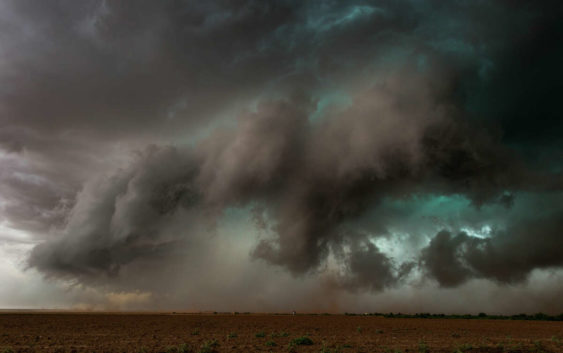
Extreme weather, a multi vortex tornado touches down in the same field as the photographer. Very dramatic weather photograph taken near Patricia in TX, USA.
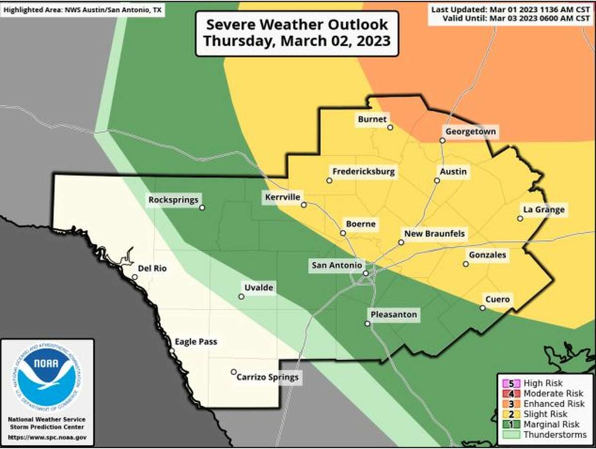
john finney photography/Getty ImagesOn Thursday, March 2 residents in the South-Central Texas regions, which include San Antonio and parts of the Texas Hill Country, could see heavy wind gusts with a chance of severe storms bringing damaging winds, tornadoes, and hail, according to the National Weather Service.
Severe storms are forecasted for the affected areas late Thursday afternoon and will continue into the evening. The Hill Country, I-35 corridor, and Costal Plains are also at risk for severe weather.
The National Weather Service has already issued high wind warnings for the Rio Grande Plains and southern Edwards Plateau, which could potentially see warm temperatures, low humidity, and winds.
Wind gusts of 40 to 60 miles per hour are expected to develop Thursday afternoon, the National Weather Service said.

Heavy winds, tornadoes, and hail possible in much of the South-Central Texas area on Thursday.
National Weather ServiceHeavy winds and dry conditions have the potential to start fires, which can spread quickly under the right circumstances. To avoid starting fires, weather experts suggest securing loose items and avoid activities that have the possibility of starting a wildfire.
The National Weather Service is also encouraging those in the way of the storm to keep a close eye on severe weather watches and warnings as conditions develop, and to identify shelter to ride out the storm.
Check back with MySA.com or follow us on social media for the latest weather updates.