- South and Midwest face potentially catastrophic rains and floods while reeling from tornadoes
- Deadly 2024 hurricanes prompt WMO to retire three names
- Body recovered in North Carolina identified as East TN man who has been missing ever since Hurricane Helene
- Report: Coastal flooding could threaten 1.4 million homes by midcentury
- Caught on camera | Tornado touches down in Missouri
Strong wind storm to affect the area Saturday

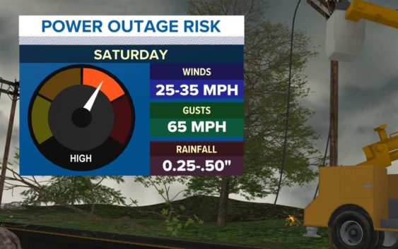
CHARLOTTE, N.C. — Start securing those loose items in the yard now because, by Saturday. We should be seeing 20-35 mph winds with gusts over 50 mph. The strong low-pressure system has an enormous wind field that is similar to the remnants of a tropical storm without all the moisture. There will be a narrow line of storms possible with the front, but that will be brief as most of the high winds will be before and after the front moves through. There is already a High Wind Watch out for most of the western Carolinas, and more counties could be added along with wind warnings and advisories.
The winds will start to pick up late Friday out of the south and southwest. They will only be 15-20 mph but indeed a breezy day. Clouds will be increasing as the evening goes on. Temperatures will be in the mid-70s Friday.
Overnight Friday into Saturday, the wind will pick up so that by the time you wake up Saturday, they will really be howling. As the front gets close by 9 am-12 pm, there will be a narrow, fast-moving line of thunderstorms that could enhance the winds as well. That rain will be brief and not the main story because as the rain moves out and the sunshine returns, the winds actually get stronger. The warming of the day and the wind flowing over the mountains will cause a deep mixing layer in the atmosphere, resulting in the stronger winds above our heads mixing down to the surface in higher and higher gusts as the day goes on. So by evening, the wind could be gusting well over 40 to 50 mph.
These types of winds will bring down some branches and trees, which then could result in scattered power outages. Also items like tens, trampolines, and other temporary structures need to be secured very well or taken down to avoid being blown away. Also, due to the dry air behind the front combined with the wind, the fire danger will be very high as well. Driving high-profile vehicles will be difficult and requires two heads on the wheel at all times.
It s a good idea to prepare for possible power outages by charging all your devices, having a flashlight, and getting items ready for the loss of power.
Saturday is certainly a day to Stay Weather Aware!