- McDowell County wildfire spreads to 500 acres, evacuation orders in place
- Evacuations in Caldwell County due to wildfire
- Northwest Houston 'ghost neighborhood' caused by repeated flooding to become latest detention basin
- NHL playoffs: Hurricanes open playoffs Easter Sunday afternoon vs. Devils
- 2 wildfires spreading in rugged terrain in western North Carolina
New hurricane-tracking TROPICS satellites launch

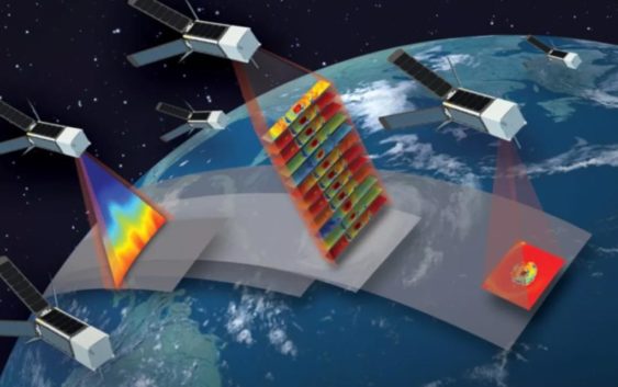
The new fleet of weather tracking satellites fly in a coordination formation in low Earth orbit and offer some of the fastest imagery refresh rates available.
CHARLOTTE, N.C. — The first in a series of new miniature satellites intended to track hurricanes and other tropical weather launched into orbit Sunday night.
For the mission, NASA contracted with Rocket Lab, which launched the first pair of new satellites from New Zealand.
The mission is called TROPICS, which stands for Time-Resolved Observations of Precipitation structure and storm Intensity with a Constellation of Smallsats.
The satellites, which are about the size of shoeboxes, are much smaller than traditional weather satellites. Once fully launched, the fleet of small satellites (sometimes called cubesats) will fly together in a synchronized formation, which is similar to how SpaceX’s Internet-providing Starlink satellites work. The flight pattern allows meteorologists and scientists to see a series of rapidly-captured images over a storm.
Weather forecasters are able to make quicker and more intimate weather-forecast decisions when they have access to new and fresh imagery from satellites and other data sources.
These satellites will fly in low Earth orbit over the tropics. Unlike other orbiting satellites which capture new images every six hours, the TROPICS satellites are anticipated to capture new images of storms every hour. They will be used in conjunction with other satellites, which ones that already provide imagery every few minutes but from a stationary orbit around the globe.
“Providing more frequent imaging will not only improve our situational awareness when a hurricane forms,” Karen St. Germain, the director of NASA’s Earth Science Division, explained in a released statement. “The data will provide information to models that help us determine how a storm is changing over time, which in turn helps to improve forecasts from our partners like the National Hurricane Center and Joint Typhoon Warning Center.”
“We look forward to increasing storm tracking capabilities with another launch later this month to complete the TROPICS constellation,” Bradley Smith, the director of Launch Services for the Space Operations Mission Directorate at NASA, wrote on the agency’s website.
The second pair of TROPICS CubeSats are planned to launch aboard another Rocket Lab Electron rocket in about two weeks. The second launch will be timed to insert the next two CubeSats into the TROPICS constellation.
The TROPICS team is led by Principal Investigator Bill Blackwell at Massachusetts Institute of Technology’s Lincoln Laboratory in Lexington, Massachusetts, and includes researchers from NASA, the National Oceanic and Atmospheric Administration, and several universities and commercial partners. NASA’s Launch Services Program, based at the agency’s Kennedy Space Center in Florida, is managing the launch service.