- 'A little emotional': Hurricanes equipment manager got seconds in goal, memory to last a lifetime
- WMO retires three hurricane names after devastating 2024 season
- Beryl removed from future hurricane naming lists
- Hurricane names Helene, Milton and Beryl are now retired
- Hurricane Helene's name retired after deadly 2024 impact on US
Hilary updates: Downgraded to post-tropical storm as SoCal hit with dangerous flash floods

SAN FRANCISCO — Tropical Storm Hilary deluged arid parts of Mexico and then drenched Southern California from the coast to the desert resort city of Palm Springs and inland mountains, forcing rescuers to pull several people from swollen rivers.
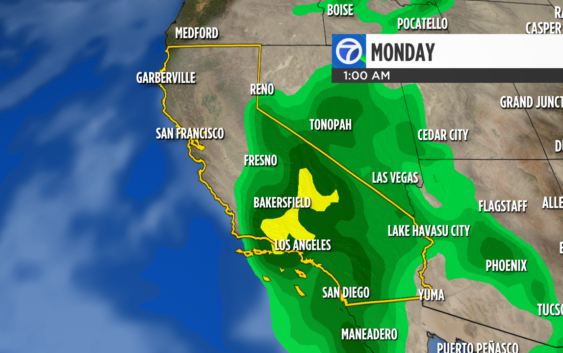
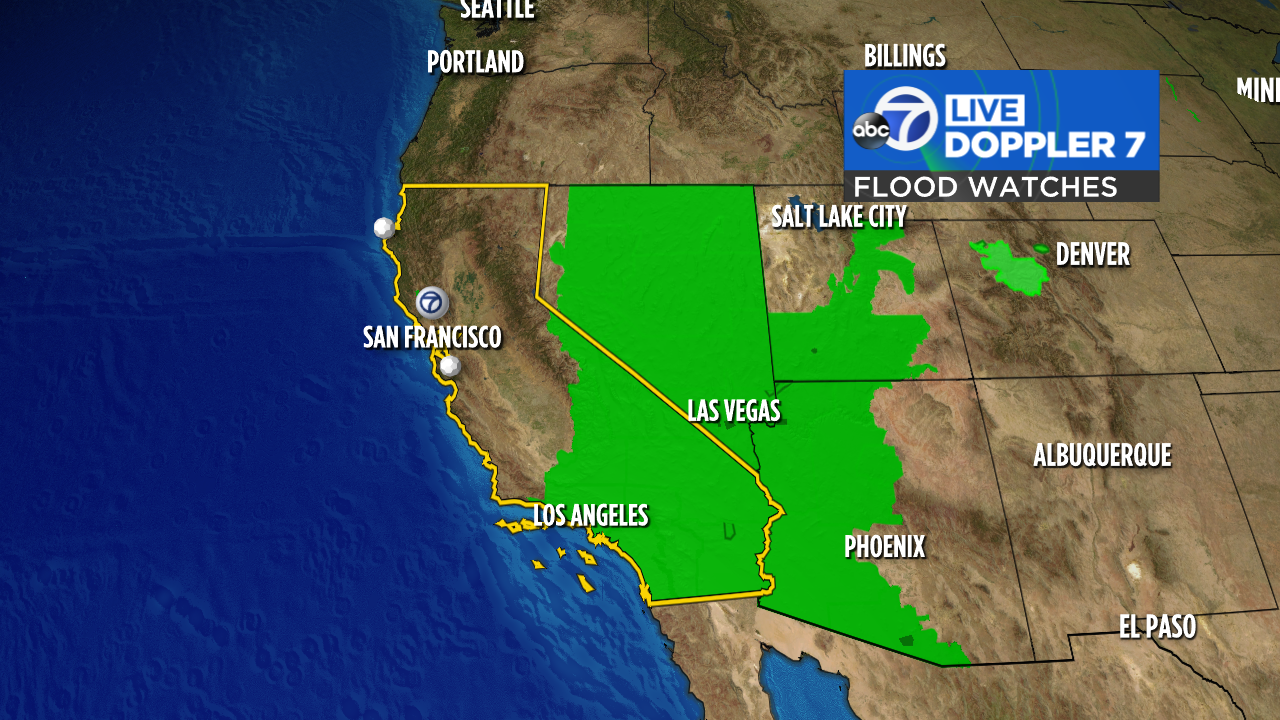
Even as the storm subsides across the coast, flooding and mudslides were expected across parts of the southwestern U.S.
LIVE: Tracking Hilary’s current path as it moves toward CA
As Tropical Hilary headed to Southern California, a 5.1 earthquake struck the area Sunday afternoon, according to the USGS.
It was upgraded from a 5.0. The quake occurred just after 2:40 p.m. near Ojai on the Sisar fault in Ventura County, the USGS said.
There will be a threat of flooding rains across Southern California through Tuesday. The U.S. National Hurricane Center issued a tropical storm watch on Friday, the first time that has ever been done.
HURRICANE HILARY
The storm first made landfall in Mexico’s arid Baja California Peninsula on Sunday in a sparsely populated area about 150 miles (250 kilometers) south of Ensenada. One person drowned in Mugele, on the eastern side of the Baja Peninsula, when a vehicle was swept away by an overflowing stream. Rescue workers saved four other people, said Edith Aguilar Villavicencio, the mayor of Mulege.
RELATED: Hurricane categories explained: How strong is each category?
Hilary then moved through mudslide-prone Tijuana, threatening the improvised homes that cling to hillsides just south of the U.S. border.
The first tropical storm to hit Southern California in 84 years, Hilary dropped more than half an average year’s worth of rain on some areas, including Palm Springs, which saw nearly 3.18 inches (8 centimeters) of rain by Sunday evening.
The National Hurricane Center in Miami downgraded Hilary to a post-tropical storm in its early Monday advisory, and warned that “continued life-threatening and locally catastrophic flooding” was expected over portions of the southwestern U.S. on Monday. All coastal warnings were discontinued.
FLASH FLOODING ACROSS SOUTHERN CALIFORNIA
Forecasters warned of dangerous flash floods across Los Angeles and Ventura Counties, and fire officials rescued 13 people from knee-deep water in a homeless encampment along the rising San Diego River. Meanwhile, rain and debris washed out some roadways and people left their cars stranded in standing water. Crews pumped floodwaters out of the emergency room at Eisenhower Medical Center in Rancho Mirage.
Sunday was the wettest day on record in San Diego, with 1.82 inches (4.6 centimeters), the National Weather Service said in a post on X, the social media platform previously known as Twitter. The previous record was on Aug. 17, 1977, when 1.8 inches (4.5 centimeters) post-Hurricane Doreen dumped record rainfall on the area.
VIDEO: Officials give update on CA’s Hurricane Hilary response, preparedness efforts
The Los Angeles Unified School District, the nation’s second largest school system, said all campuses would be closed on Monday, as did districts across the region. San Diego schools postponed the first day of classes from Monday to Tuesday.
The Palm Springs Police Department said in a statement Sunday that 911 lines were down and that in the event of an emergency to text 911 or reach out to the nearest police or fire station.
The storm was projected to weaken as it continued moving northward over California and into Nevada, but Richard Pasch, a hurricane specialist with the National Hurricane Center, said “very heavy” rain and strong winds are still likely.
CENTRAL VALLEY IMPACTS
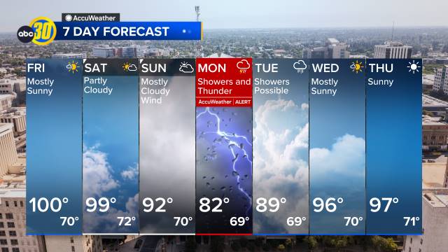
Rainfall is expected in parts of the Central Valley Sunday night into Monday morning.
Most parts of the Central Valley experienced a precursor to Hilary’s arrival when rain and thunderstorms arrived Saturday night, knocking out power and trees throughout cities like Fresno and Clovis.
High winds are something to consider as wind speeds are expected to be over 20 mph throughout the Valley.
Central Valley residents coming from and heading to Southern California should expect rough driving conditions through the Grapevine at I-5.
The Grapevine is expected to have 2-4 inches of rainfall and winds up to 20-30 mph, with gusts up to 45 mph.
BAY AREA IMPACTS
RELATED: Hurricane Hilary: Bay Area unlikely to see severe weather from storm as it takes aim at SoCal
The current track of Hilary keeps the bulk of the moisture in Southern California and the Sierra but, we still have a possibility of seeing isolated showers here Sunday and a chance of showers Monday. Remnants of Hilary will bring higher humidity and tropical cloud cover between Sunday and early next week.
We will monitor the track of this storm and any small shifts would mean an increased chance of rain here. That is something we will fine-tune in the coming days.
INTERACTIVE: Look up how climate change is forecast to impact your neighborhood
ABC7 News contributed to this report.
Watch the latest AccuWeather forecast and take a look at recent weather stories and videos.
If you’re on the ABC7 News app, click here to watch live


