- Hundreds of brush fires burn across North Carolina Saturday; several fires still burning Sunday
- Texas’ biggest wildfire started a year ago. How does the Panhandle look now?
- To her, Hurricane Helene debris isn’t trash. It is full of memories — and she’s returning them
- Bills introduced a year after state’s largest blaze seek to limit wildfires
- A year after Texas’ largest wildfire, Panhandle residents tugged between hope and anxiety
Hurricane Idalia tracker: Maps, live radar show storm's path, potential impact on Florida
Watch live radar in the media player below as the Category 2 storm moves into Georgia and the Carolinas.
ByEmily Shapiro and Ivan Pereira 
Wednesday, August 30, 2023 1:17PM

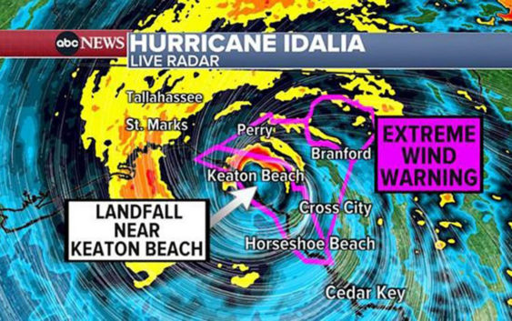
MIAMI — Hurricane Idalia has roared ashore in Florida, making landfall in the Big Bend region just before 8 a.m. Wednesday as a powerful Category 3 hurricane. It has since been downgraded to a Category 2 storm.
Wind gusts have reached 85 mph.
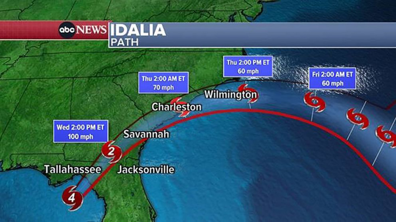
Hurricane Idalia path on Aug. 30, 2023.
Life-threatening storm surge is a major threat.
Storm surge is already flooding most of the coastal Tampa Bay area, where the surge could reach 6 feet.
The storm surge could hit 16 feet near Cedar Key and the Big Bend area and could reach 5 feet in the flood-vulnerable cities of Savannah, Georgia, and Charleston, South Carolina.
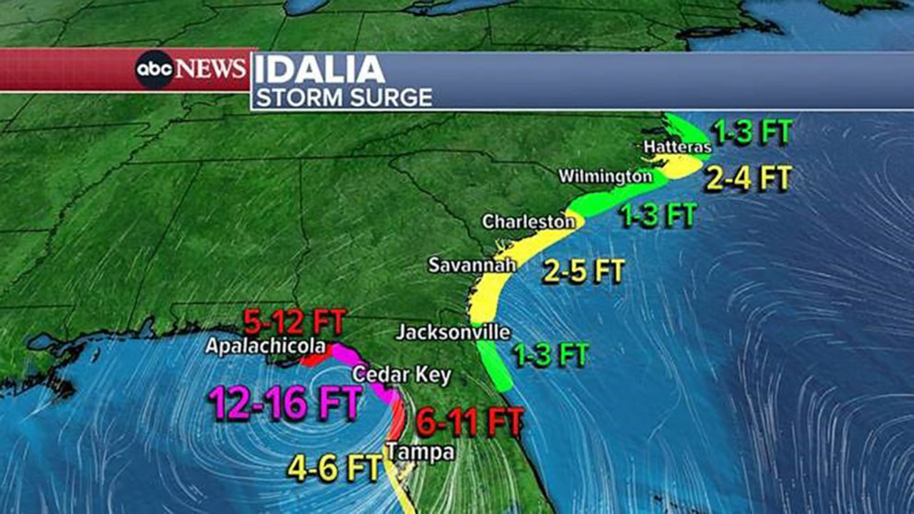
Hurricane Idalia storm surge on Aug. 30, 2023.
Heavy rain — up to 1 foot — as well as flash flooding are expected from Georgia to the Carolinas.
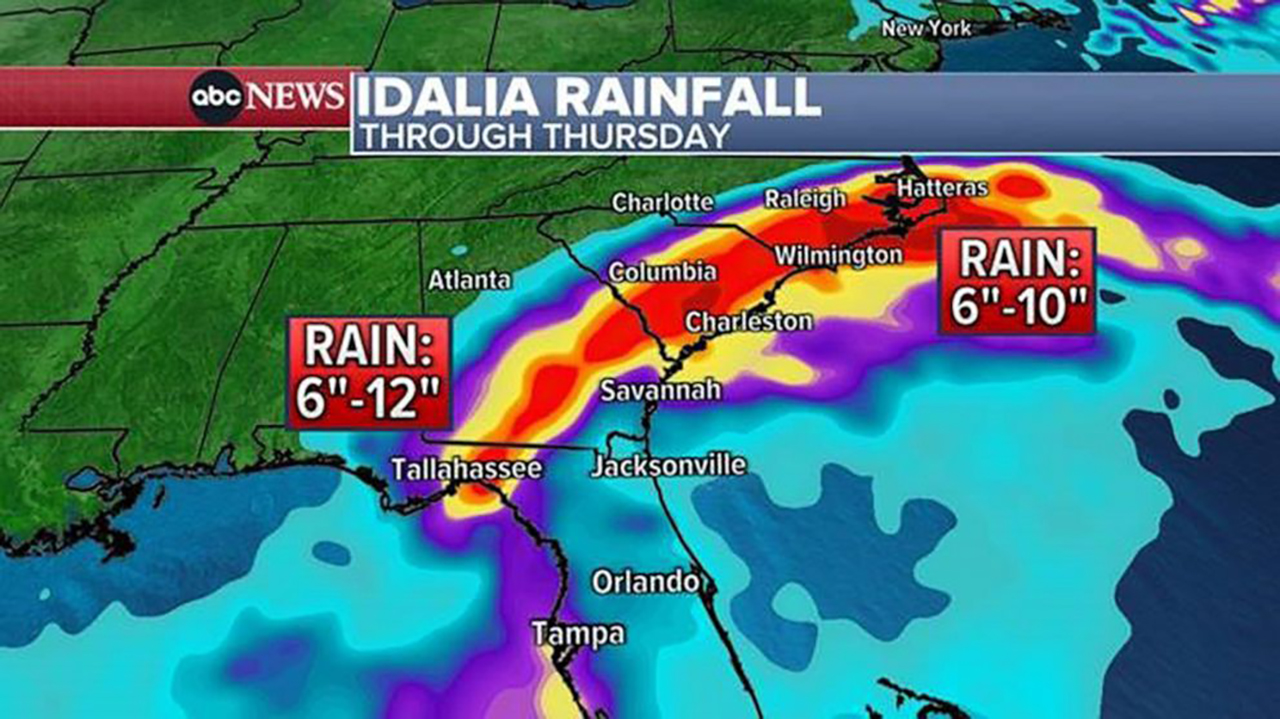
Hurricane Idalia rainfall through Thursday.
Copyright © 2023 ABC News Internet Ventures.
Related Topics