- CenterPoint Energy accelerates infrastructure improvements ahead of hurricane season
- Carolina Hurricanes playoff tickets go on sale Thursday
- Ask the Meteorologist: Why do tornadoes target Tornado Alley, Dixie Alley?
- Nonprofit closes distribution site that aided thousands after Hurricane Helene
- Trump approves federal assistance amid Arkansas flooding
Flood Watch in effect for the Hill Country through Thursday morning
Parts of the Hill Country could see as much as 4 to 6 inches of rain. Here’s the latest on the timing and flood threat.
AUSTIN, Texas — You’ll want to keep your umbrella nearby as we monitor scattered rain chances almost each and every day this week.
Timing
Our midweek rain chances will be the most notable so far this period. As we head through Wednesday, a frontal system will add more moisture and increase our rain chances for Wednesday evening and the first half of Thursday.
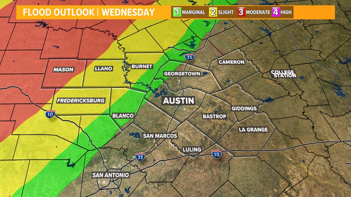
Currently only the Hill Country is included in a marginal risk for severe weather Wednesday night. Additionally, Mason County is in a “moderate” – 3 out of 4 – risk for excessive rainfall which could produce flash flooding.

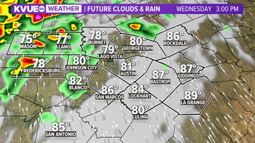
From 3 p.m. to about 8 p.m. the majority of the rain and storms will stall to the west of I-35 and the Hill Country, which is why the bulk of rain activity this week will build up there. If you are in Mason, Gillespie, or Llano County isolated area could see another 3-5 inches of rain Wednesday evening through Thursday morning.

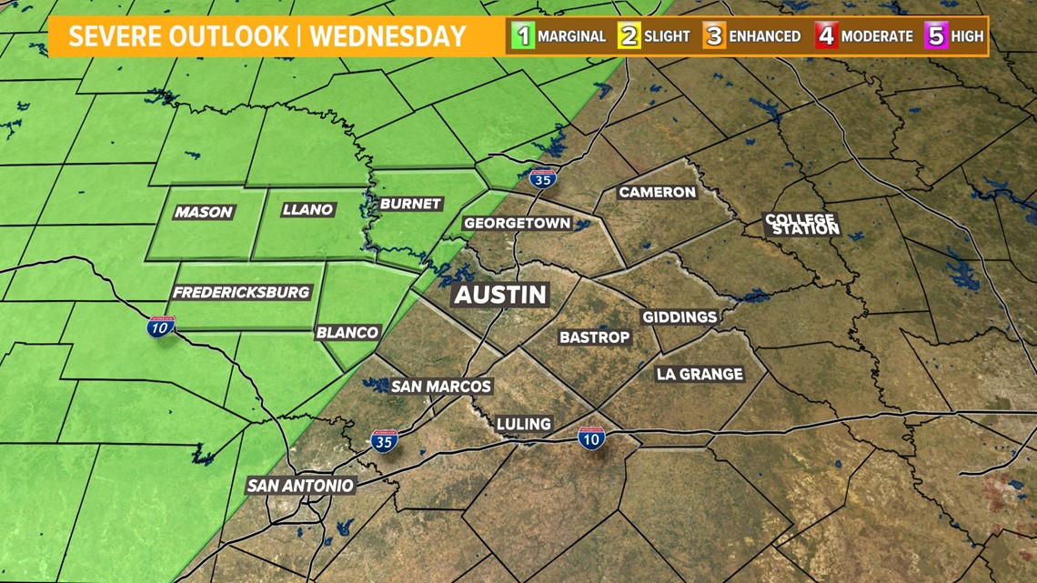
Added risks with tonight’s storms will be gusty winds and some rotation that could lead to brief spin up tornadoes. The hail risk has been cut down to zero as of Wednesday afternoon. Our main concern will be flash flooding.


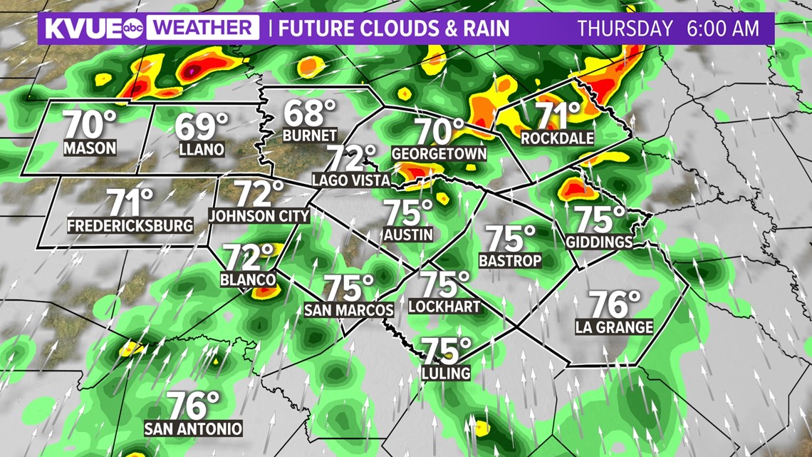
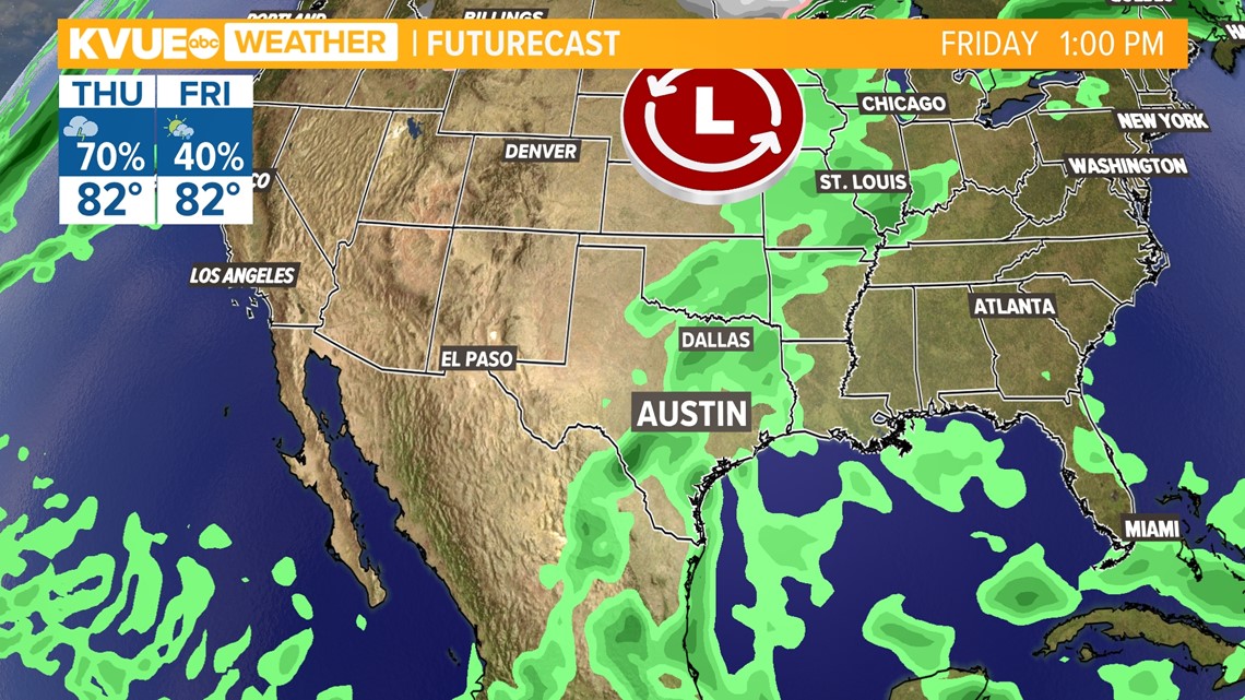
As we head into Thursday morning, the boundary of moisture will eventually break through to the central and east side of town. Since the river of moisture is headed NNE slowly, it will take awhile for things to dry out again, don’t expect to get back to your outdoor plans until Friday at the earliest. The rain will benefit our Highland Lakes system, and help replenish lake reserves a bit, but we will need more rain to help the extreme drought.

Rainfall
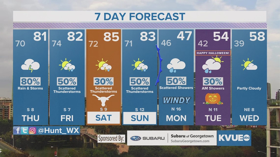
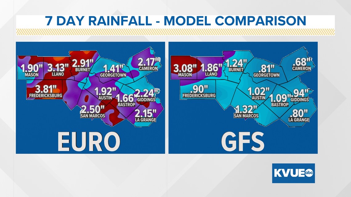
The rainfall forecast has increased across forecast models, especially due to a strong cold front expected to arrive at the beginning of next week. Over the 7-day period, day-to-day rainfall may not be much to write home about. However, cumulatively, expect at least an inch in most places, and maybe over 2-3″ inches in the Hill Country. Again, the higher amounts west of Central Texas could still provide a benefit for our Highland Lakes based on streamflow data.

Stick with KVUE for the latest on this developing forecast.
In the meantime, your seven-day outlook is below.

