- CenterPoint Energy accelerates infrastructure improvements ahead of hurricane season
- Carolina Hurricanes playoff tickets go on sale Thursday
- Ask the Meteorologist: Why do tornadoes target Tornado Alley, Dixie Alley?
- Nonprofit closes distribution site that aided thousands after Hurricane Helene
- Trump approves federal assistance amid Arkansas flooding
Flood Watch cancelled early; drier this evening before more rain on Friday
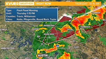
A Flood Watch is now in effect for the I-35 corridor and the Hill Country through 1 p.m. Thursday.
AUSTIN, Texas — It has already been a wet week for Central Texas with some locations picking up more than six inches of rain over the past 24 hours. Now we’re looking ahead to another round of widespread rain Thursday morning. This is rain that we need, but we are also tracking the potential for some flooding.
The greatest flood concern will be across the Hill Country and the I-35 corridor. A Flash Flood Warning is in effect until 7:30 a.m. for portions of Northwestern Gillespie County and Western Llano County. A Flood Warning is in effect for Llano River at Llano until Thursday evening. A Flood Watch is now in effect for the Hill Country and I-35 corridor through 1 p.m. on Thursday. 1 to 3 inches of rainfall will be possible with isolated pockets getting as much as 4 to 6 inches. In fact, a flood warning is now in effect for eastern Travis and eastern Williamson counties until 1:15 p.m. as a result.


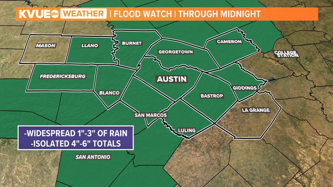
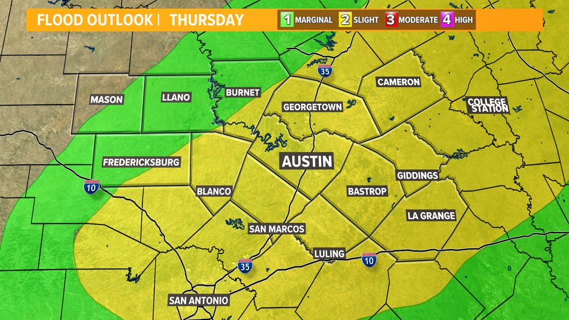
With the Flood Watch now including the Austin metro, the flood risk for the I-35 corridor has increased to the ‘slight’ – level 2 of 4 – risk. The ‘moderate’ – level 3 of 4 – risk now includes parts of northwest Travis and Williamson County.
The flood risk is greatest for the Hill Country, but flooding will be a possibility across the metro as well. There could be standing water on some roadways for the morning commute and the morning hours of Thursday. Remember, turn around don’t drown!

Through the late evening hours of Wednesday, the bulk of the rain has stayed across the Hill Country. However, rain and storms will slowly progress eastward into the I-35 corridor Thursday. Again, we expect that the morning commute for much of the metro could be stormy.

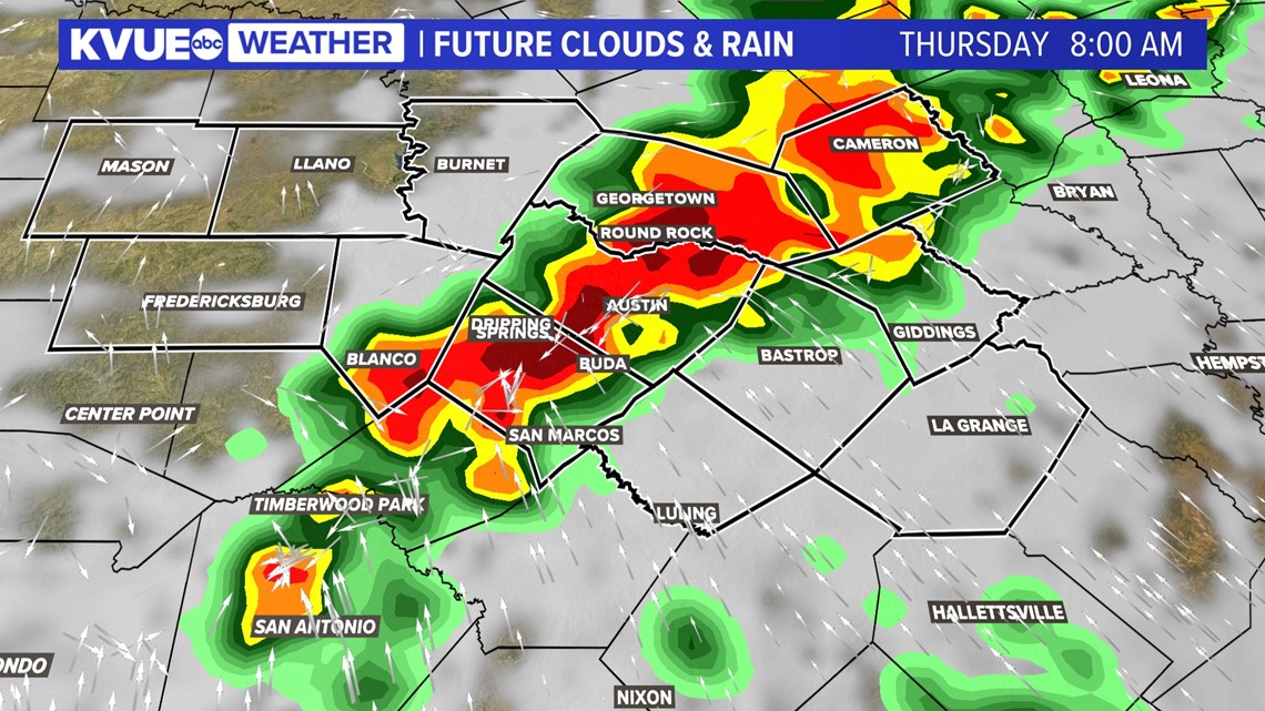
Rain and storms will continue along and east of I-35 through the mid to late morning and into the early afternoon hours. Drier conditions will gradually push in by Thursday evening.

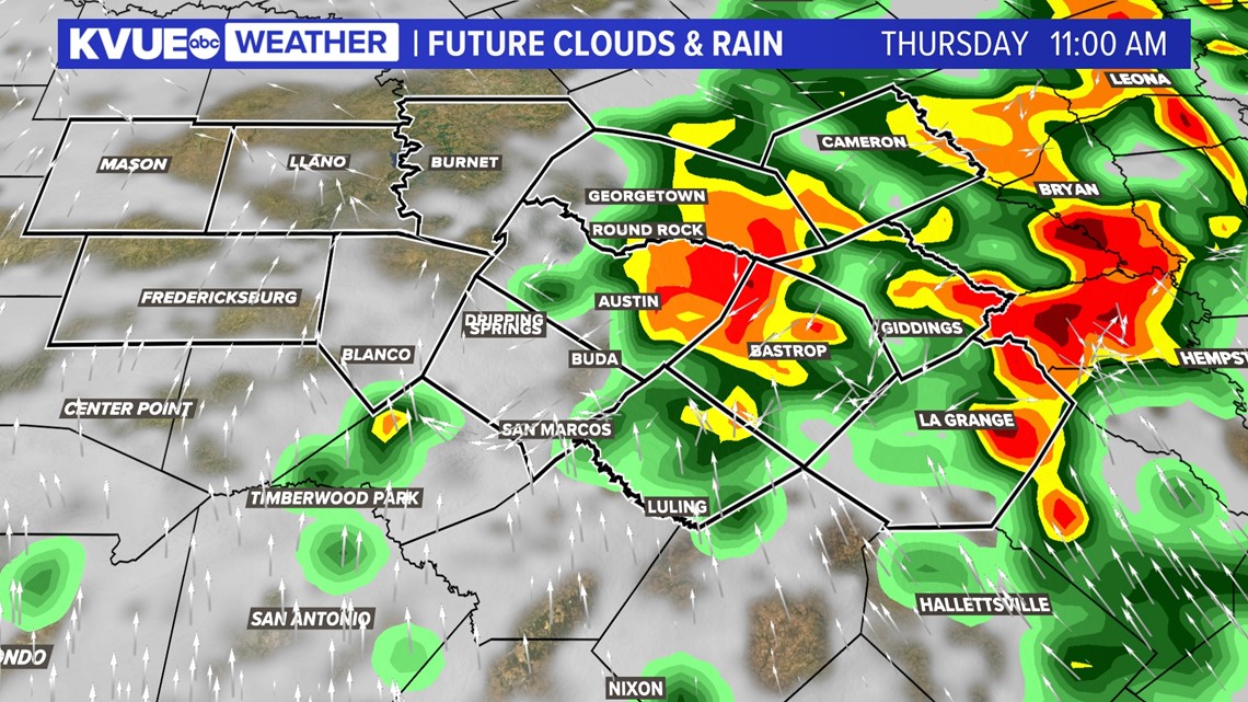
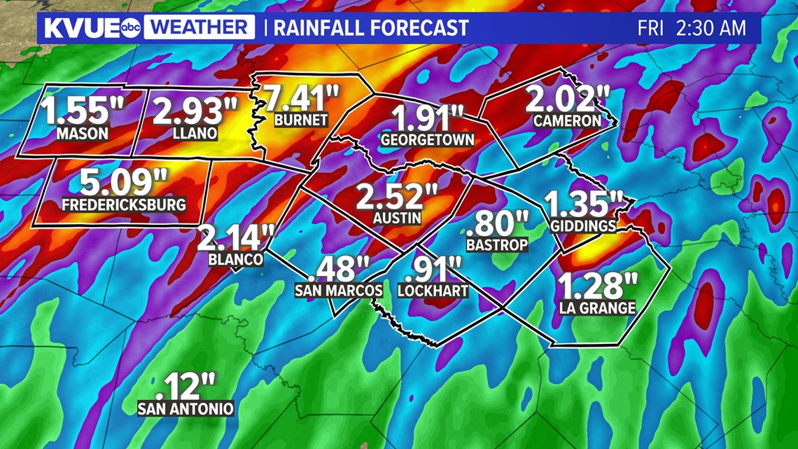
Rainfall totals will be highest across the Hill Country where pockets of 4″ to 7″ of rain will be possible. This could be great news for the ongoing drought and our lake levels, but could also cause issues with flooding. Please make sure you have a way to get weather alerts through Thursday morning.
Totals in the metro and east of I-35 will be generally 1″ to 3″ with isolated pockets of 4″ to 6″. This could also cause localized issues with flooding.

The KVUE Weather Team will continue to monitor this developing forecast.
In the meantime, the extended forecast can be found below:

