- Dangerous travel conditions: Ice, snow and flooding possible
- How photos lost in disasters like Hurricane Helene find their way home, with a little help from people who care
- Dangerous travel conditions, ice/snow and flooding possible in the mountains Tuesday and Wednesday
- Weather Impact Alert: Dangerous travel conditions, ice/snow and flooding possible in the mountains Tuesday and Wednesday
- North Carolinians perplexed by unexpected DMV refunds tied to Hurricane Helene relief
Tornado Watch in effect for Cape Fear until 9 pm, as storms continue to impact area
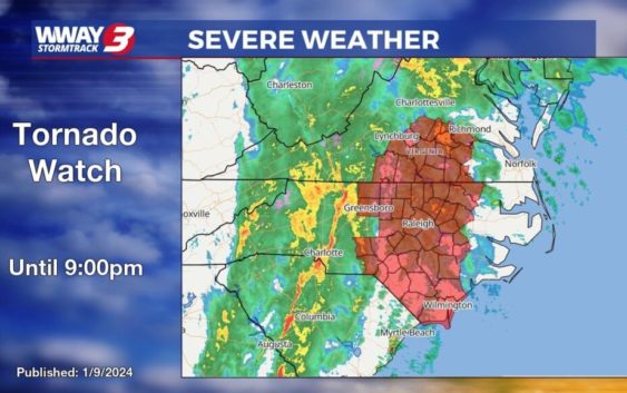
WILMINGTON, NC (WWAY) — It’s been an active weather day across the Cape Fear.
Several tornado warnings have been issued, though no touchdowns have been confirmed.
A few downed trees have been reported. But no major damage has taken place.
The entire area remains under a tornado watch until 9:00 p.m. Tuesday evening.
A powerful squall line will race across the area, bringing strong winds and heavy rain before the threat moves offshore.