- Report: Coastal flooding could threaten 1.4 million homes by midcentury
- Caught on camera | Tornado touches down in Missouri
- Carolina Hurricanes playoff tickets go on sale next week
- Storms kill 6 in the South and Midwest as forecasters warn of catastrophic rains, floods this week
- Weather Impact Alert: Cold front could trigger severe weather in Houston area this weekend | See timeline
Flood Watch now expired for San Antonio, communities to the east

Follow KENS 5 on air and online for breaking severe weather coverage. Get the KENS 5 app for alerts when severe weather threatens South Texas.
SAN ANTONIO — A Flood Watch has now expired for San Antonio and locations east of I-35 into the coastal plains, where the heaviest rainfall has fallen over the last several days.
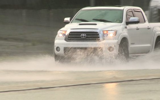
Additional rounds of moderate to heavy rain are possible as authorities continue warning commuters not to drive on flooded roadways. The National Weather Service says an additional one to two inches could fall in the Alamo City as a soggy week continues. Rememer: turn around, don’t drown!
Parts of DeWitt, Gonzales, Guadalupe, Karnes, Lavaca and Wilson counties also remain under a Flood Watch until noon Thursday.
The National Weather Service is advising drivers it is dangerous to use the roads. The organization is expected 1-3 inches of rain in the San Antonio area and parts of the area east of I-35. Additionally, they say localize river flooding is possible.
Early Wednesday morning, folks in the Pearsall area saw up to quarter-sized hail. Several KENS 5 viewers sent in photos of the hail. See the gallery below:
KENS 5 viewers share their weather pictures
Power outages
CPS Energy is reporting less than 100 customers are without power as of 12:00 p.m. Check the CPS outage map below for more details:
The San Antonio River Authority is reporting 24 roads closed due to high water as of 12:00 p.m. Wednesday in Bexar County. They remind you that it is illegal to drive around barricades at low water crossings. If you see water over the road, please turn around and find a different route.
This is a developing weather event. Refresh the page for the latest updates.
SEVERE WEATHER 101
When severe weather threatens the area, it is important to know what risks a storm can bring and what you should do to stay safe.
One of the most important things to know is where you are located on a map, so when a watch or warning is put into place, you can identify if you are at risk. When the National Weather Service puts out warnings, they are county-based and sometimes include cities as well. It is important to know where you live in the county and that you can identify it on a map.
It is also important to know the difference between a watch and a warning. A watch means that conditions are favorable for something to happen, but a warning means that something has developed and it is important to take action.
So, what would cause a thunderstorm to be qualified as a “severe” thunderstorm?
Hail that is one inch large is also considered to be about the size of a quarter.
Another ingredient that would lead to a storm becoming severe is if winds are 58 mph or greater.
Winds at this strength could cause damage to roofs and could even cause trees to be knocked down.
Finally, if a tornado is present inside a thunderstorm it would qualify the storm as becoming severe.
In this instance, a tornado warning would be issued.
A tornado watch can be issued for an area if strong storms are expected, and if the storms bring the risk for tornadoes, but not all storms include the threat for tornadoes. The ingredients in the atmosphere for a tornado to form are not always there when storms are present.
If the area you are in is ever under a tornado warning, it is important to know where you should go inside your home.
Head to the lowest, interior room of your home. The basement would be best, but if you don’t have one, head to the first floor of the home and get away from exterior walls, or walls that lead to the outside of the home.
It is also important to stay away from glass. The more walls you can put between you and the outside, the better.
While lightning can be frequent in storms and very dangerous, it does not lead to a storm being qualified as severe.
Remember, when thunder roars, go indoors.
Storms can also lead to flooding. Flooding may not cause a storm to be labeled as being severe, but it is the deadliest kind of weather.
South Texas is known to have major flood events every few years, so it is important to use caution and to always stay out of floodwaters. Remember, turn around, don’t drown.
Entering flood water is very dangerous as you can be swept off of your feet and you don’t know what could be in the water that could hurt you.
The best thing you can do to be ready for severe weather is know what you will do in the event it strikes where you live.
Make sure your family has a severe weather action plan.
Have a place everyone goes inside your home and keep supplies there, such as food, medication, batteries, and flashlights.
Weather Minds Classroom: Take a class in Severe Weather 101
Follow the KENS 5 Weather Team
Don’t forget you can download the KENS 5 app for the latest news and weather information each day while you are on the go.