- CenterPoint Energy accelerates infrastructure improvements ahead of hurricane season
- Carolina Hurricanes playoff tickets go on sale Thursday
- Ask the Meteorologist: Why do tornadoes target Tornado Alley, Dixie Alley?
- Nonprofit closes distribution site that aided thousands after Hurricane Helene
- Trump approves federal assistance amid Arkansas flooding
High fire danger remains for parts of Central Texas as massive wildfire in Texas Panhandle burns
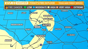
Outdoor burning is discouraged as blustery, dry weather affects drought-stricken areas.
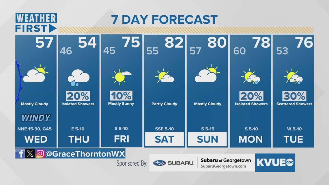
AUSTIN, Texas — A strong cold front moved through the Austin area early Wednesday, causing a major boost in wind flow and dry conditions.
These are two major ingredients in the potential for wildfires, along with the ongoing drought for the western portions of Central Texas.
The Texas A&M Forest Service promoted portions of Travis, Williamson, Burnet, and Hays counties to a high risk for fire danger Wednesday as firefighters left Central Texas to help with the massive wildfire in the Texas Panhandle.

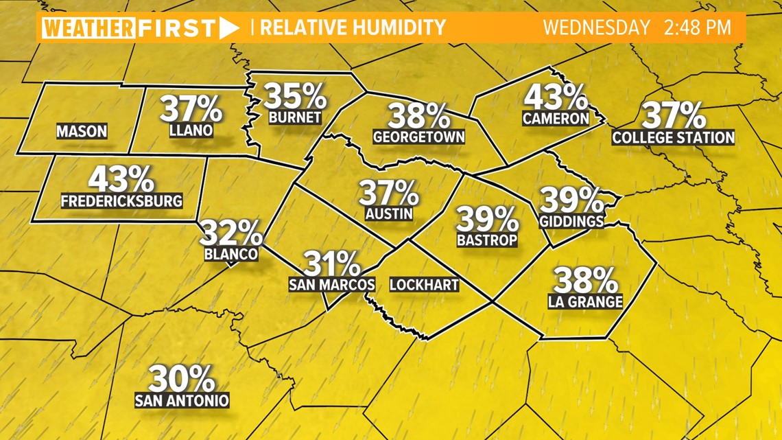
While temperatures are certainly below average for today, humidity values are also on the downturn. Humidity was near 80% for Monday and Tuesday and is down to 30 to 40% for Wednesday.

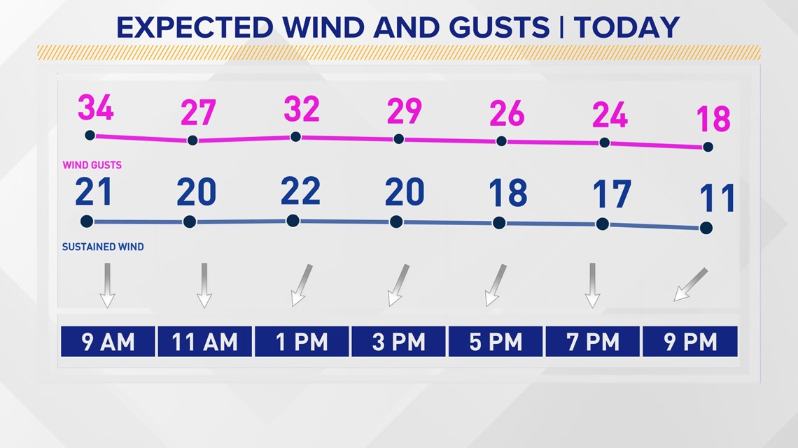
While a Wind Advisory is only intact through 4 p.m., the windy conditions won’t die down until late Wednesday. Throughout the evening, gusts will still be ranging between 20 to 25 mph.

We’ve had a lot of wildfire concerns not just here in Austin, but across the state as well.
Smoke from the Smokehouse Creek Fire that continues to engulf the Texas Panhandle made its way into the atmosphere and traversed south over several hours. As of Wednesday afternoon, the wildfire spread to an estimated 850,000 acres and is only 3% contained, according to the Texas A&M Forest Service.

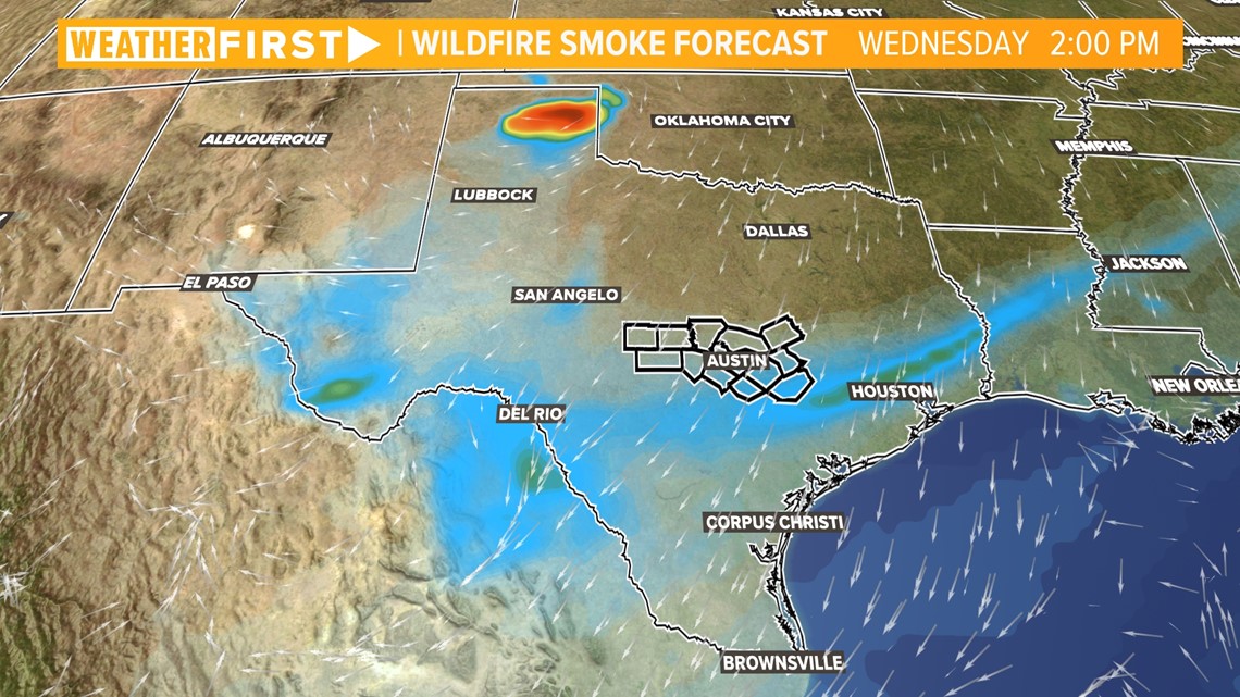
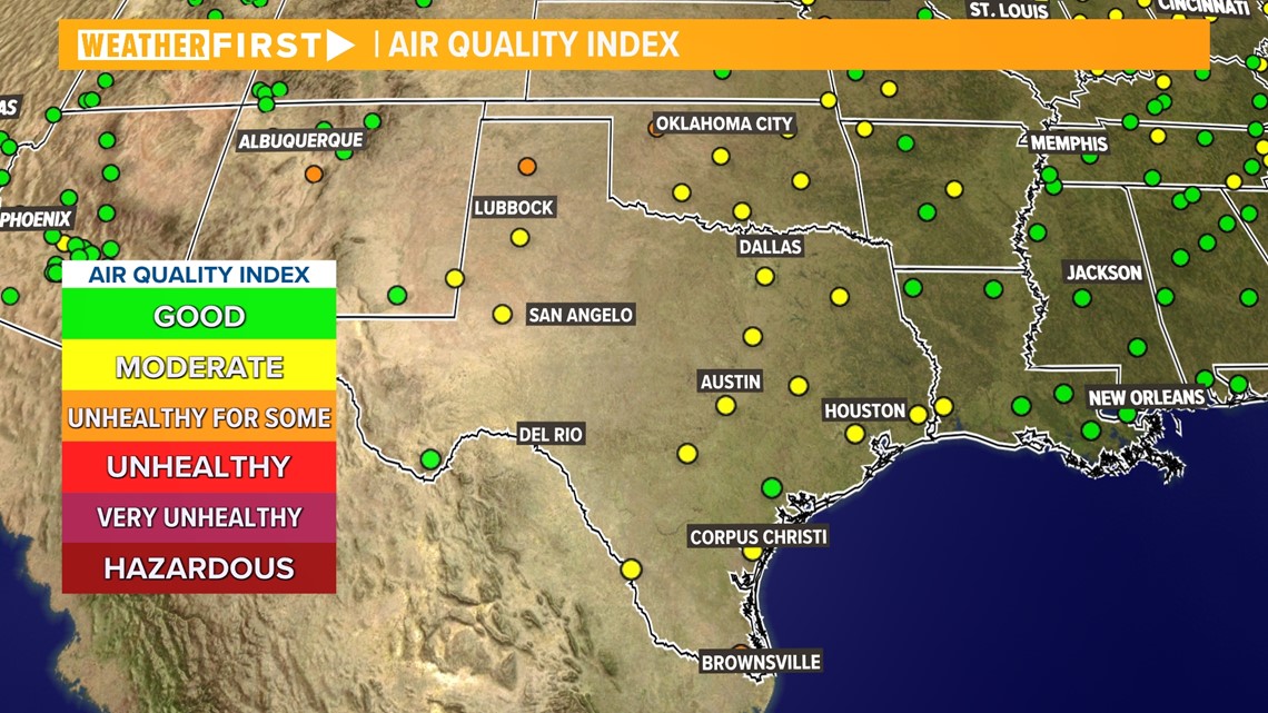
The smoke led to moderate air quality issues across Austin on Wednesday, but it may have been hard to notice at ground level due to the expanse of cloud cover.
In addition, we have another high pollen count for Wednesday, which could bother sensitive populations spending extended periods outdoors.

Thankfully as we shift into Thursday, we will be looking at the return of showery conditions, which will help us go back to a moderate or low risk for fire danger to end the week.

